Depending on the region of Kentucky in which you leave, the concept of a flood differs entirely. To the western Kentuckian accustomed to acres upon acres of flat cropland near the Ohio River, rising waters inundate the soil. And while damaging, there is little surprising when rainfall and upstream gauges indicate what is to come. At the opposite end of the spectrum are the hollow valleys in eastern Kentucky where a flash flood can wash out all a family knows in a matter of second. There is no warning. Central Kentucky lies somewhere in between. Regardless of how the floodwaters impact you or your region, when the waters rise they can cause tremendous damage. To livelihoods, to buildings, to towns, and to the land itself.
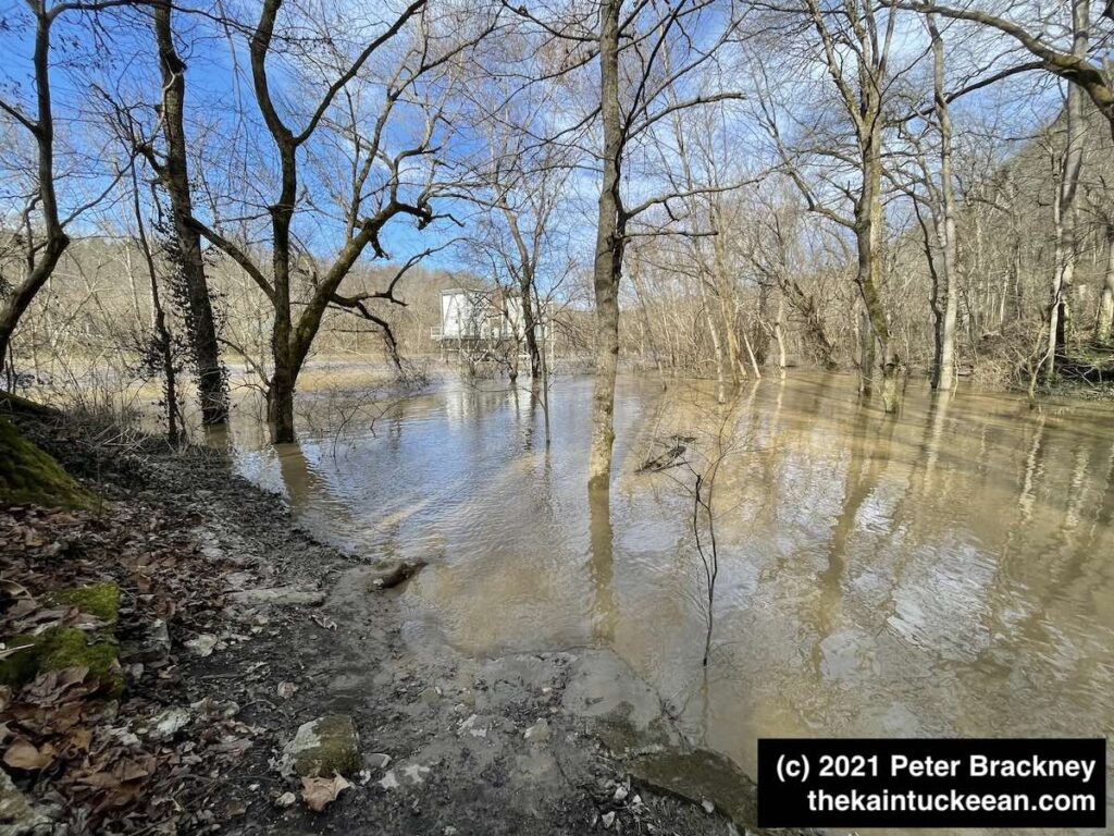
I have hiked Asbury Trails a few times so far in 2021. There was torrential rain on February 28, 2021, which led to significant flooding along the Kentucky River. I mean, significant. In the fall of 2020, the kids and I tossed rocks into the river from a rocky beach at the base of the Wilmore water intake. It’s been awhile since I’ve seen much of that little beach.
The water intake pumps were constructed in 1973 by Asbury University (nee College) before being transferred to Wilmore in 1977. In the picture below, you can see the intake pump near the center of the photograph. If you are familiar with these trails, you might notice immediately that the walking bridge is not in this focus as it is entirely submerged. Yeah.
Waterlogged Asbury Trails on March 5, 2021. Author’s collection.
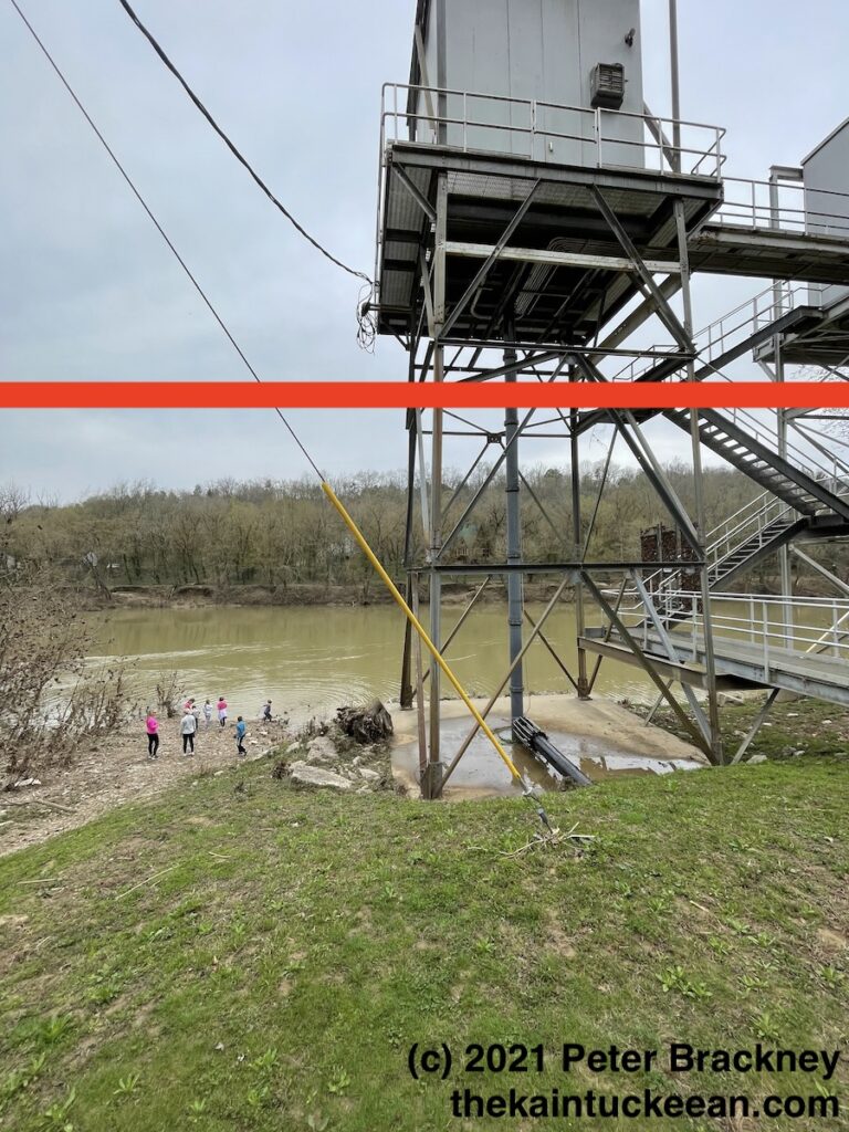
For a closer look at the water intake – and for comparison for how things should look, I offer the following photograph from March 27, 2021:
Wilmore Water Intake at the Kentucky River, March 27, 2021. Author’s collection.
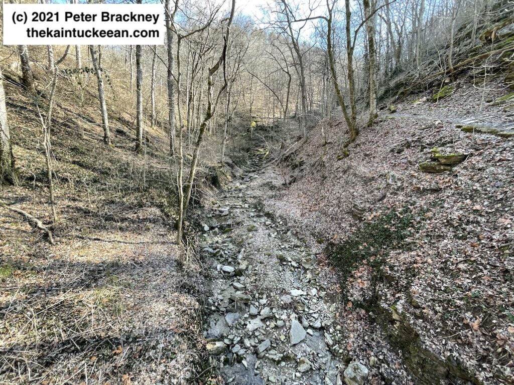
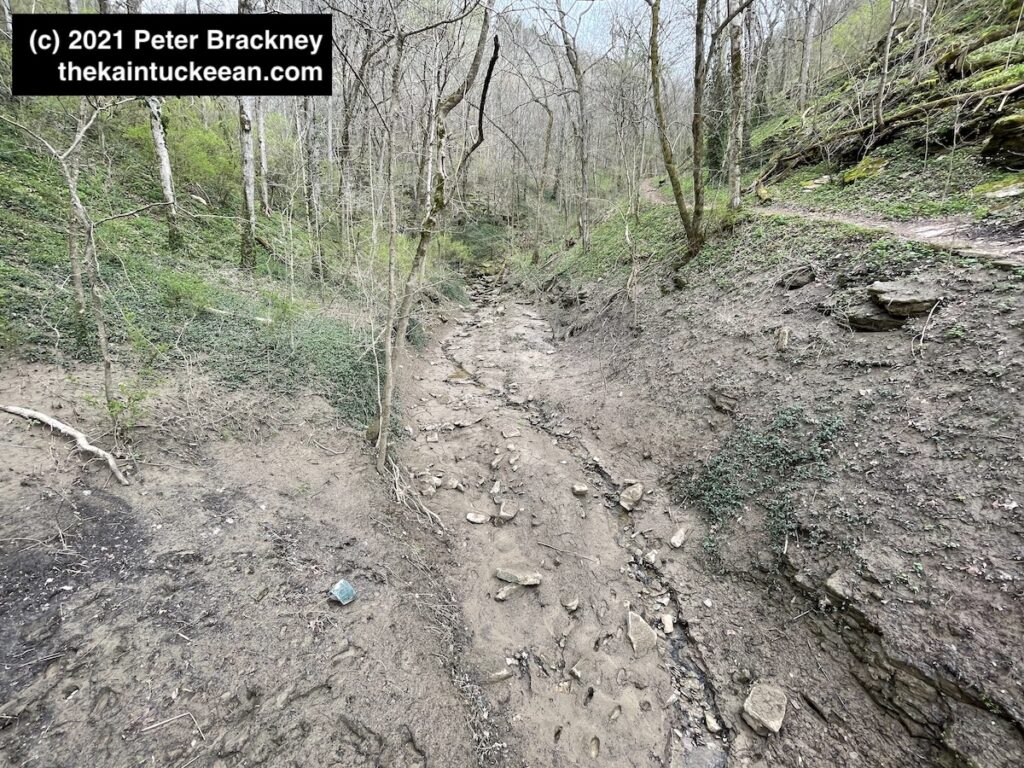
The red line indicates the high water mark that I personally observed earlier in March. From a different before-after perspective, the photograph immediately below is from early February 2021. The rock and leaf covered creekbed runs through the center of Asbury Trails. The second photograph shows the destruction caused from the late February rains. Remember that in both pictures, I am standing on a bridge that was completely submerged during the days of the rising waters.
Pre-flood from the Asbury Trails bridge, 5 February 2021. Author’s collection. Post-flood, from the Asbury Trails bridge, 27 March 2021. Author’s collection.
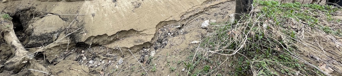
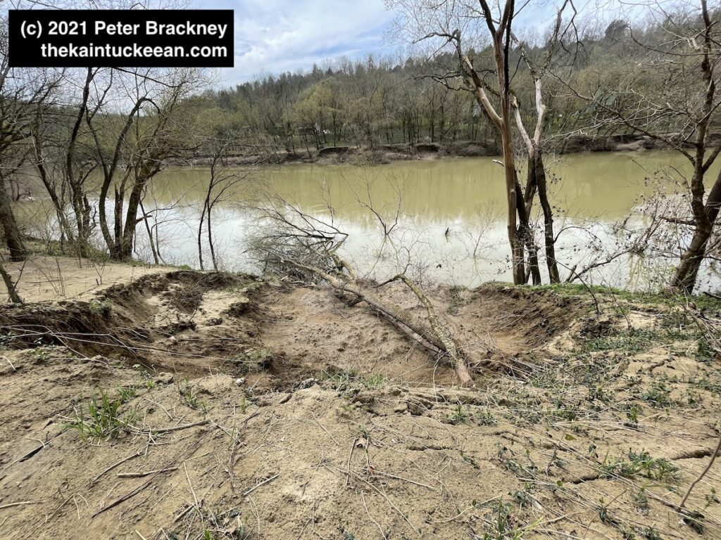
You can also see a new rut being created as the land evolves and the fresh rainwaters of March 2021 find their way to the Kentucky River. One final photograph of the land’s evolution is below showing the soil erosion adjacent to the trail as it runs alongside the river toward the spring, cave, and waterfall. Across the river, additional erosion was also visible.
Erosion visible on 27 March 2021 along the Kentucky River following late February/early March floods. Author’s collection.
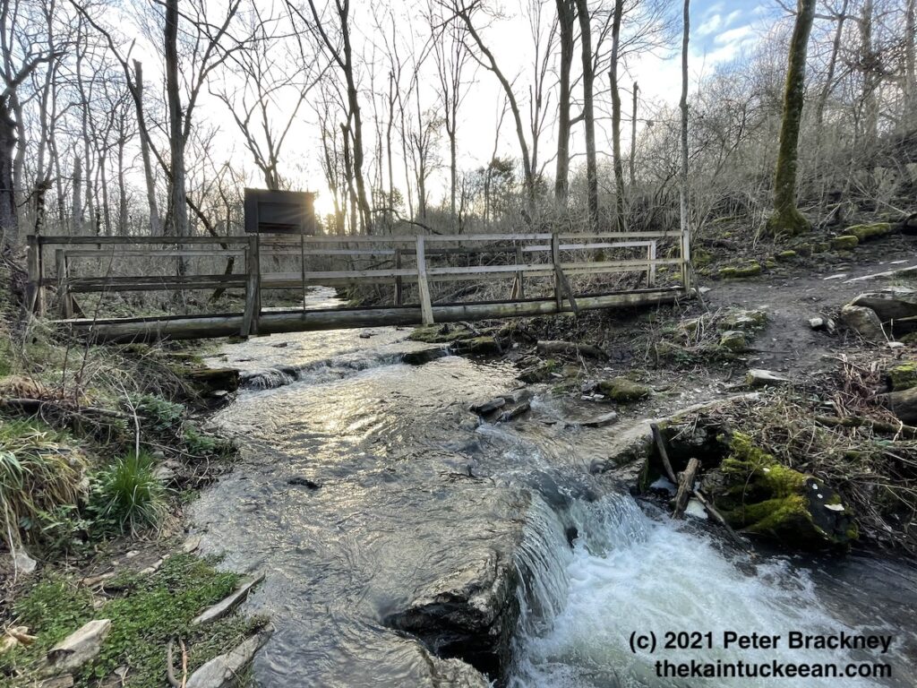
Overstreet Creek Bridge on the Jessamine Creek Gorge Trail. Author’s collection.
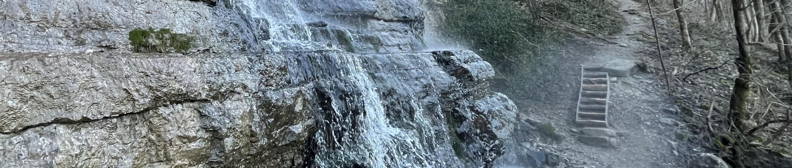
For several years I have heard about the beautiful Jessamine Creek Gorge that cuts through central Jessamine County on its way to the Kentucky River. Part of the Kentucky River Palisades region, rocks exposed along this tributary are also magnificent.
Strong rains had fallen during midweek through Thursday, so a Friday morning hike seemed like the optimal time to explore this resource so close to Lexington. Adding to the enjoyment was the late winter date as some have commented that the trail becomes both overcrowded and overgrown later in the season. I dealt with neither, however, and thus had a splendid experience. The flora later in the season is also said to spectacular, so it may be another example of beauty being in the eye of the beholder.
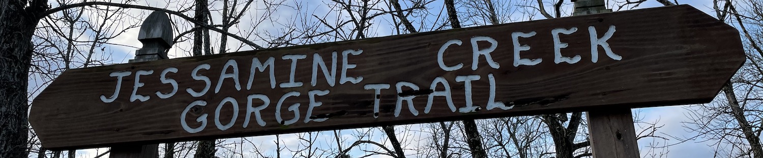
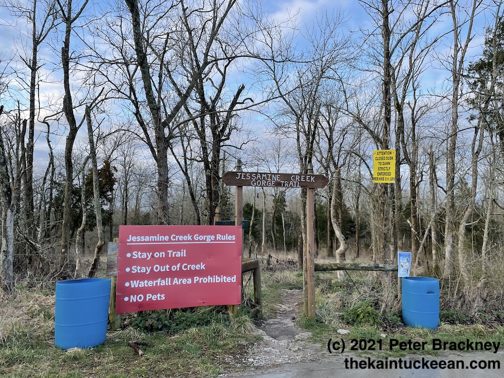
Jessamine Creek Trail Entrance. Author’s collection.
Jessamine Creek Gorge is an ecologically sensitive area. Please observe local ordinances and park rules. Stay on the marked trail. No trespassing onto neighboring properties. Don’t leave trash in the preserve. There is a trash can at the parking lot. Park in the parking lot. Do not park anywhere along the road other than the parking lot. Ignoring the rules may result in the preserve being closed to visitors by Jessamine County Fiscal Court.
The trail itself is a little politically sensitive so following these rules is über-critical. Like staying on marked trails: yes, there’s an amazing 76-foot waterfall on Overstreet Creek. No, you can’t see it from the trail. Deal with it. There’s plenty more beauty to enjoy.
Jessamine’s Etymology
Jessamine County was carved from Fayette County in 1798. It was named after a flower that grew along the banks of the creek which already bore the name from an Indian tongue. Other accounts suggest that the county was named after the daughter of a settler, Jessamine, was scalped near the site. The naming of Jessamine County is unique under either story as it traditionally considered the only Kentucky county with a feminine name.
Under either account, the creek and the county around it are beautiful. These words appeared in the Lexington Leader on May 31, 1897: “Jessamine Creek is one of the most beautiful streams in Kentucky. It is not the unusually beautiful scenery along the banks of the creek, or its soft, clear limestone water which makes it an object of so much interest; but the stories of the many sad tragedies which have been enacted along its banks and in its waters.”
Dam Jessamine Creek?
In an attempt to control massive flooding along the Kentucky River, a proposal during the 1940s and 1950s would have seen a 148-foot tall dam constructed along the Kentucky River near the mouth of Jessamine Creek. According to a publication by the Army Corp of Engineers, Engineering the Kentucky River: The Commonwealth’s Waterway, such a construction project would have “submerged 21,500 acres of the Kentucky valley and ended navigation of the river upstream of Lock No. 7.”
Preservationists and others decried the project and it thus never received Congressional funding and never was constructed. Instead, levees and floodwalls were utilized to protect the Capital City (which was the main purpose for the proposal). Although the Jessamine Creek Dam project was first initiated in the early 1940s, it was finally killed in 1962. The timeline mirrored Frankfort’s Craw neighborhood.
A Beautiful Hike
It is said that a picture is worth a thousand words. When it comes to these hikes, I’d argue that a short video is worth a thousand pictures. Enjoy and please share your experiences of hiking at Jessamine Creek Gorge in the comments!
Beyond Wilmore lies a quiet country road from which you can find the Asbury Trails which are owned by Asbury University. These trails overlook the Palisades and descend to the Kentucky River. Because of their proximity to Lexington, they are trails which I tend to frequent.
Asbury Trails are so close to Lexington, yet a world apart. As Lexington has grown, it is more and more difficult to find accessible natural locations where you can rejuvenate the mind, body, and spirit. Raven Run and McConnell Springs are both good locations in Fayette County, but there are many more great hiking locations in central Kentucky especially along the banks and bluffs on either side of the Kentucky River.
The Kentucky River Palisades rise some 400 feet on either side of the Kentucky River in what geologists call an entrenched meander. According to the trails brochure, “about ten million years ago the Bluegrass was a flat, low lying area. The Kentucky river slowly wound across a wide plan. Then eastern America experienced a broad uplift, raising this area 400 feet [and the] river began cutting into the uplifted plateau.” Silt build up at bends in the river also led to the formation of landings, many of which became crossings for buffalo and later settlers (and even later, bridges) over or through the water.
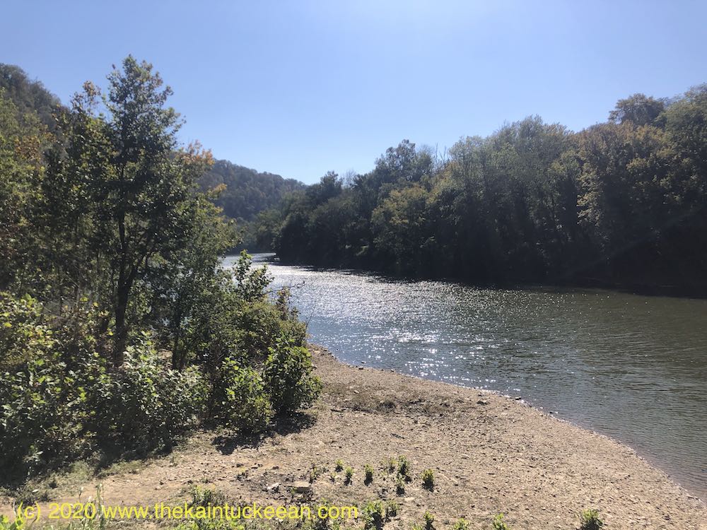
At the river, the Asbury Trails reach one such location. The small, rocky beach is adjacent to the city of Wilmore’s water intake tower which draws up 2 million gallons per day for the city’s water usage.
The Kentucky River at Asbury Trails. Author’s collection.
According to the Jessamine County Kentucky River Task Force, “toll roads were privately built for profit (if any) in conjunction with specific ferries. The Fulkerson Ferry was chartered at this site in 1789 and was in use when a toll road was built in the mid-1800’s for travel between Lexington, Harrodsburg, and the Shaker community at Pleasant Hill in Mercer County. Prior to its use as a stage crossing, it was a major buffalo crossing at the shallow sand bar here.” On the Mercer County side of the river,
Stage coach houses were built on both sides of the river to accommodate travelers and horses. Known stage lines using this crossing were The Smith Stage Coach Line and the Lexington-Harrodsburg Line.
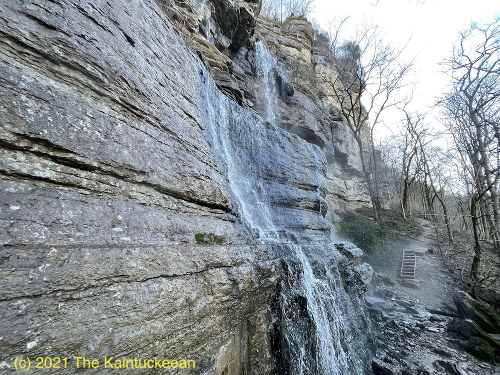
Waterfall along the Asbury Trails. Author’s collection.
The trails consist of a half-mile Hillside Trail which follows along the top of the bluff ending in a meadow after passing through woods and across the ravine. The Old Stage Road Trail, three-quarter miles in length, descends 350 feet from the bluff along one side of the ravine toward the river. A bridge at the end of the trail cuts over to the old crossing and the intake tower. A gravel road descends on the opposite side of the ravine to complete the loop.
At the end of the Old Stage Road Trail is the beginning of a quarter-mile Great Wall Trail which gives the best vista of the rock formations that make up the Palisades. (The trail actually continues more than the 0.25 miles, but the “unofficial” trail extends beyond Asbury’s property line.)
These short trails are beautiful and worth visiting.
A short montage of photographs from a recent winter visit to Asbury Trails.
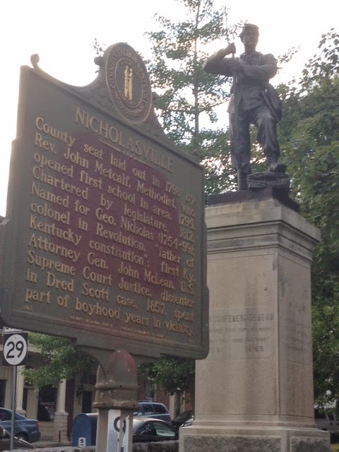
The scaffolding has recently been taken down from the courthouse in downtown Nicholasville as the Jessamine County structure’s significant renovation nears completion.
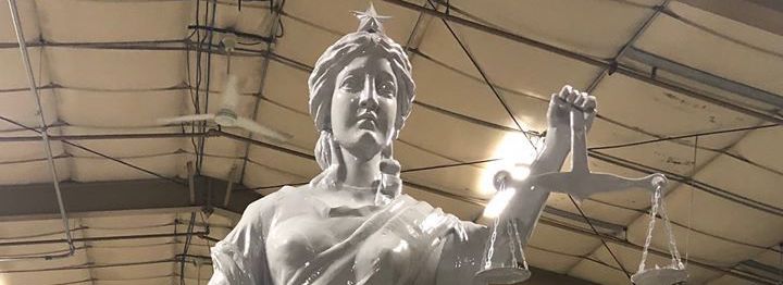
Part of the renovation included a complete restoration of the Lady of Justice statues which again stand atop the courthouse holding in her hand the scales of justice.
But the courthouse renovation should be viewed as incomplete. There remains one more item that requires completion: removal of the Confederate Monument.
A renovated Lady Justice before installation atop the courthouse. Doug Fain.
Jessamine’s Confederate Monument
The Confederate Monument standing on the courthouse lawn in downtown Nicholasville is significant and imposing. The seven-foot tall soldier stands upon an even taller 11-foot base. It is, by far, the largest monument at the historic courthouse.
The courthouse lawn, like the capitol in Frankfort, is a place where we honor and glorify. These are places where laws are written and enforced. Because we, as a nation, believe in equal justice under the law it is not right for our symbols in this important spaces to honor and glorify bias or prejudice.
So what does the Jessamine Confederate Monument honor and glorify?
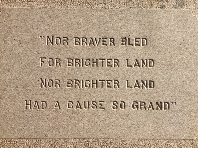
Its base contains various inscriptions which memorialize that ‘Lost Cause’ telling of history. Among the most offensive is this one: “Nor braver bled for brighter land nor brighter land had a cause so grand.” The words do nothing but glorify the South and the systemic racism with which our nation still struggles.
It does not belong on the lawn of a county’s seat of justice. It does not belong on the lawn of my county’s seat of justice.
Inscription on the base of the Jessamine Confederate Monument. Author’s collection.
Most curiously, the statue was originally that of a Union soldier to be located in an Ohio town. That town, however, could not raise the necessary funds. The Jessamine County association purchased the statue from the stone company for $1,500 and the belt buckle was modified from ‘USA’ to ‘CSA’.
As the largest monument at the courthouse, the glorification of the Confederacy (which fought against the United States) diminishes others who are honored for their service in the Revolutionary War. Other conflicts in which Jessamine Countians fought for the United States are not recognized by monuments on the lawn. Yet, those who fought against the United States receive oversized glory.
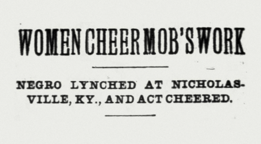
A Lynching at the Monument
The Confederacy stood to retain an economic system that enslaved Black Americans. Jim Crow kept a knee upon the necks of freed African-Americans after Reconstruction hurriedly ended with the Compromise of 1877. The Ku Klux Klan intimidated. Justice was denied and unequally applied. It is a stained history that America has not overcome.
One of the worst symbols of this systemic mistreatment exists at the end of a rope thrown over the branch of a tree. Six years after the Confederate Monument was dedicated on the courthouse lawn and only feet away from that monument, a lynching occurred. The date was February 6, 1902. A 19-year-old black man, accused of assaulting a white woman, was seized by a mob of some 200 people from the local jail. On the courthouse lawn in the shadow of the Confederate Monument, the mob lynched Thomas Brown in Nicholasville, Kentucky.
When the monument was dedicated in 1896, it was done to memorialize the Confederate soldiers who had been disinterred from Camp Nelson and reburied at Maple Grove Cemetery just down Main Street in Nicholasville. It would seem altogether fitting for the statue to be relocated there to the cemetery.
Such a move would follow what happened in Lexington with the relocation of the John C. Breckinridge and John Hunt Morgan statues from the courthouse lawn to the Lexington Cemetery. As a result, the monument could still tell a history (hopefully one that has been appropriately contextualized), but in a place that does not cause the monument to function as a state-sanctioned glorification of the Confederacy.
The courthouse is a county-owned property and governed by the county’s fiscal court. Maple Grove Cemetery is city-owned. Both would need to consent to the relocation of the statue. And, of course, funding (or donated services) would need to be secured to remove and relocate the statue.
The monument is, however, protected by state law. The Kentucky Military Heritage Commission serves as the gatekeeper against any listed site being “damaged or destroyed, removed or significantly altered” without the Commission’s written consent. Removal of the statue, or relocation to Maple Grove Cemetery, would require approval from the Military Heritage Commission.
My own arc toward justice
First, I must make my own confession. In 2014, I wrote columns for The Jessamine Journal. In one, I recognized the statue without appropriate context. I didn’t fully consider the impact the statue might have on black defendant seeking their own justice. Or of the inherent discrimination standing in front of the very source of our county’s judicial system. The presence of the Confederate Monument on the ground contradicts the existence of Lady Justice on the roof. I should have, but did not, write the column you are now reading in 2015. Then, however, I called for the removal of the statues in front of the Fayette County Courthouse. I should have written a different column in 2014 and I should have written another in 2015; I regret having waited another five years to write this one. But today, I write that the Confederate Monument on Jessamine County’s courthouse lawn needs to be removed.
The article I wrote in 2014 quoted Col. Bennett H. Young. Young wrote the definitive history on Jessamine County in 1898 and was present at the 1896 dedication of the statue. He was a Confederate veteran who found the statue the “handsomest” in the county. Young was leading an effort to tell the story of the Confederacy, and all it stood for, through the innocent sounding ‘Lost Cause’ mantra.
Colonel Young had his own agenda, however. Though he wrote a definitive history for the county, his own past identified him as one who fought against the United States during the Civil War. By glorifying a ‘Lost Cause,’ he was part of the effort to rewrite history. It is now time to make sure that our history is properly told.
Today’s Jessamine County
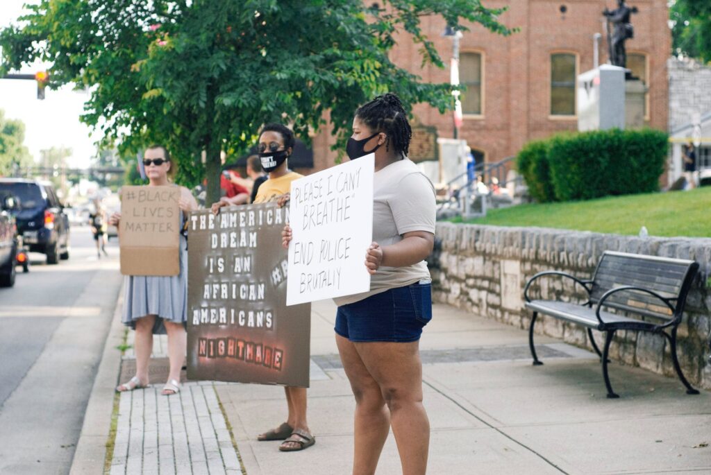
Last Saturday, a Black Lives Matter protest rally was held in front of the courthouse on Main Street in Nicholasville. This coming Saturday, similar events are being planned in both Nicholasville and Wilmore.
Across the Commonwealth, similar protest rallies are occurring in surprising places. The national and international rage over the murder of George Floyd, Breonna Taylor, and others is being felt here in Jessamine County. There is a sense of urgency to do what is right. In Jessamine County, one step toward righting centuries of wrong is to no longer glorify systemic racism in the heart of our city in front of the courthouse. The Jessamine Confederate Monument must be removed.
There will be opposition, some of it angry opposition, to the statue’s removal. The newly restored statue of Lady Justice must be the symbol of what we pursue in Jessamine County: that simple creed upon which our nation was founded “that all … are created equal.” Some opponents will say that history is being whitewashed by the statue’s removal; to the contrary, the ‘Lost Cause’ sought to revise history a century ago. The statue must be removed from the courthouse lawn because what it represents is not justice.
Black Lives Matter Rally in Nicholasville on 6 June 2020. The Confederate Monument is in the upper-right of the image’s background. Jessamine in the Raw.
In a conversation with another local historian, I recently learned the location of Clays Mill.
The spokes out of Lexington each head somewhere. Harrodsburg Road goes to Harrodsburg. Nicholasville Road to Nicholasville. Old Frankfort Pike. Well, you get it. If you consider all the springs and creeks around our community, then consider all of the roads with names related to that lost topography and industry that has been covered with residential and commercial zoning and structures.
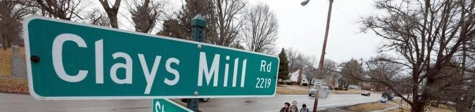
Armstrong Mill. Or Millpond. Which is close to Spring Run Road. Then there is Higbee Mill. But probably the most significant “mill” road in today’s Lexington is Clays Mill (historically written Clay’s Mill).
Clays Mill Road Today
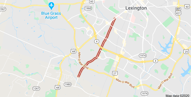
Google Maps.
Clays Mill Road runs from Harrodsburg Road all the way into Jessamine County where it terminates at Brannon Road. The map above shows Clays Mill Road, in red, from where it begins to the Fayette-Jessamine County line. You can see just south of there where the road now terminates in Fayette County.
The road itself was once two-lane the entire distance until a proposal begun in 2002 led toward the road’s widening. The proposal was opposed by many neighbors because of the increased traffic and character change that would result from the project.
Another oft-mentioned project, once in the state’s six-year road budget, was the construction of an exchange from New Circle Road at Clays Mill. That project was “indefinitely delayed” in July 1985.
Clay’s Mill Road of History
But the Clays Mill Road of today (or even of 35 years ago) doesn’t answer the historical questions of the road. In 2003, it was posed in the Lexington Herald-Leader: “Did the Clay family own a mill for which Clays Mill Road is named and, if so, where was it located?”
It’s a good question. Newtown Pike ended in Newtown. When you drive out Richmond Road, you’d eventually arrive in Richmond. But driving out Clays Mill only takes you to Brannon Road.
The newspaper’s answer: “The Clay family mill was owned by Marston Clay and was sold to Samuel Barkley in 1803. The mill was located in Jessamine County on the Jessamine Creek near what is presently the end of Clays Mill Road where it connects to Brannon Road.”
Whoever wrote the answer for the newspaper clearly didn’t travel out Clays Mill Road. If they had, they’d discover that Jessamine Creek isn’t close to Brannon Road.
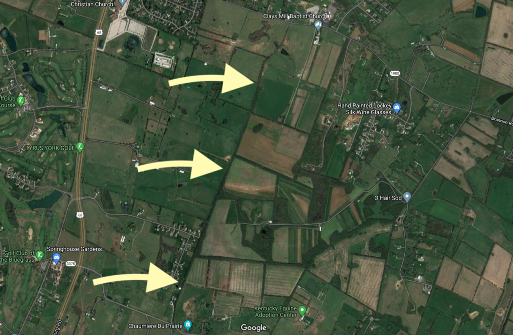
Thats because Clays Mill Road was once much longer than we think.
In the map above, the arrows point to a treeline which follow the old path of the Clays Mill Road. At the top of the map is Brannon Road and at the bottom is Catnip Hill Road in Jessamine County (you can see the reference to Chaumiere du Prarie at the very bottom of the map).
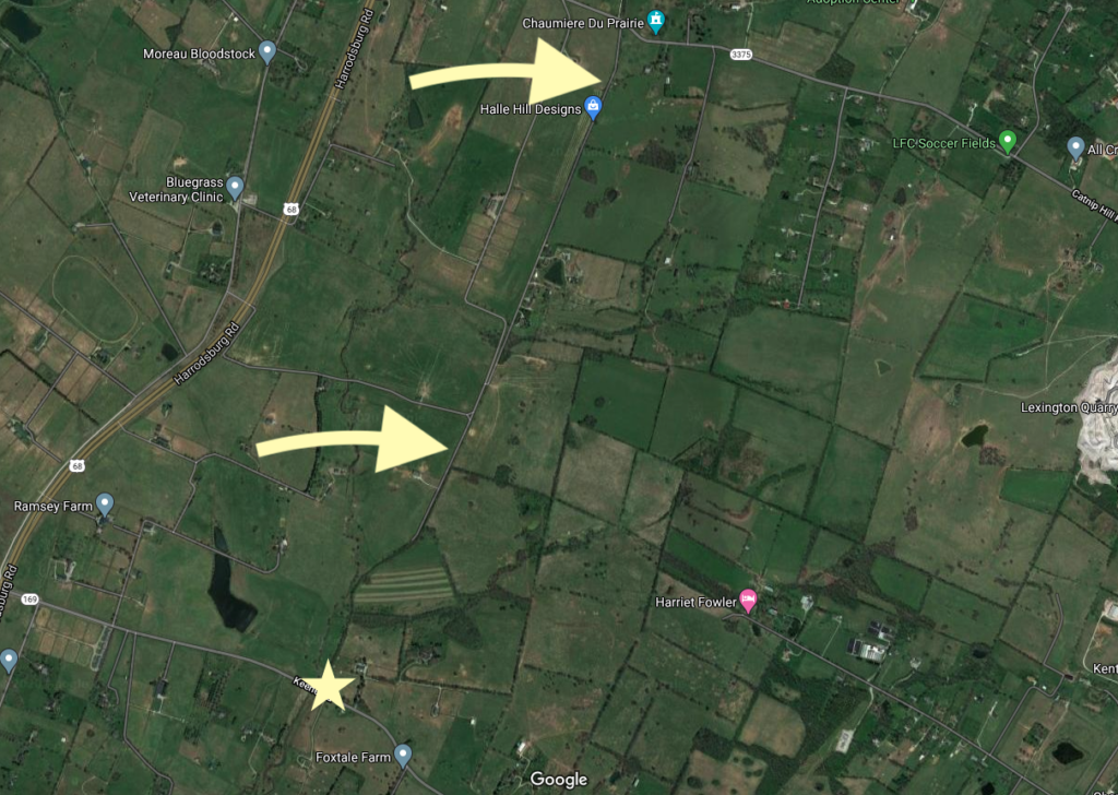
On the south side of Catnip Hill Road is a 1.6 mile road called Rhineheimer Lane. it is a straight shot almost the entire distance to KY-169/Keene Road in Jessamine County. The two yellow arrows in the map above point to Rhineheimer Lane. And the star — well, that is the site of the old mill. The old Clay’s Mill.
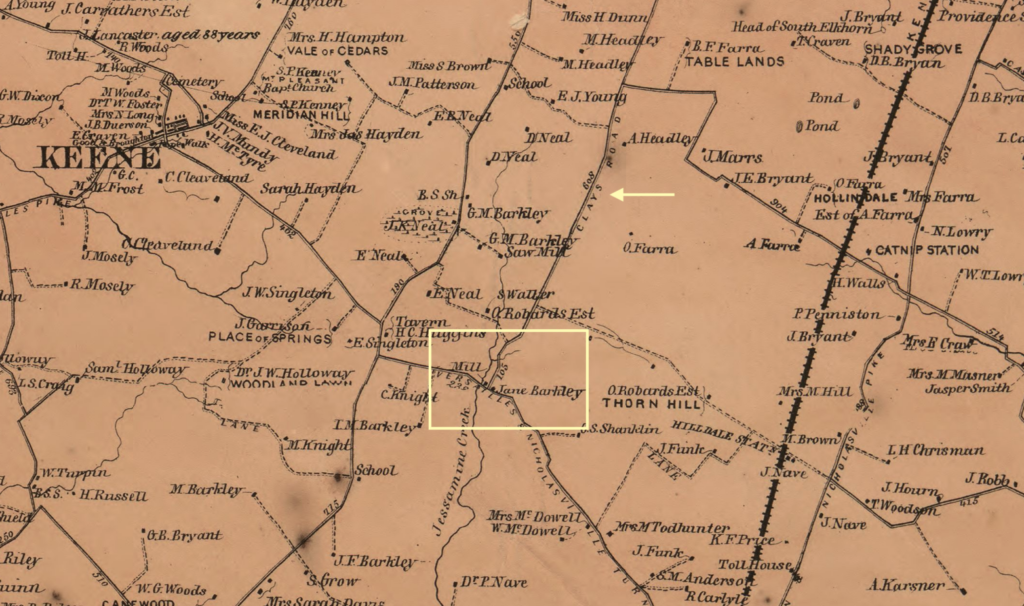
In the yellow square added to the 1861 map above, you can see the “Mill” adjacent to property identified as being that of Jane Barkley (which matches the newspaper’s account noted above). The small arrow points to another sign: Clays Road.
History Repeats Itself
Yes, I’m a history junkie. But I also like to follow the future growth of central Kentucky. As a result, I tend to read things like the Nicholasville-Jessamine County Joint Comprehensive Plan every time it updates. It was last updated in 2017.
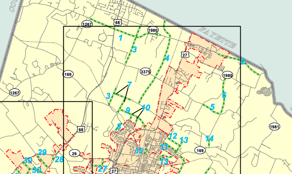
Buried on page 62 is information about a proposed “local connector road” is this potential future addition: “Begin at Clays Mill Road Extension south to meet Rhineheimer Lane at Catnip Hill Road; continue from south end of Rhineheimer Lane south to meet Keene Road.”
This proposed project is identified as “3” on the map below. (Another interesting project, “4” would extend Lexington’s Boston Road all the way to Baker Lane in Jessamine County. With these local connectors planned, you can anticipate a lot of residential growth in northern Jessamine County.
If/when completed, the old course of Clays Mill will once again run its full course. History has a funny way of repeating itself, doesn’t it?
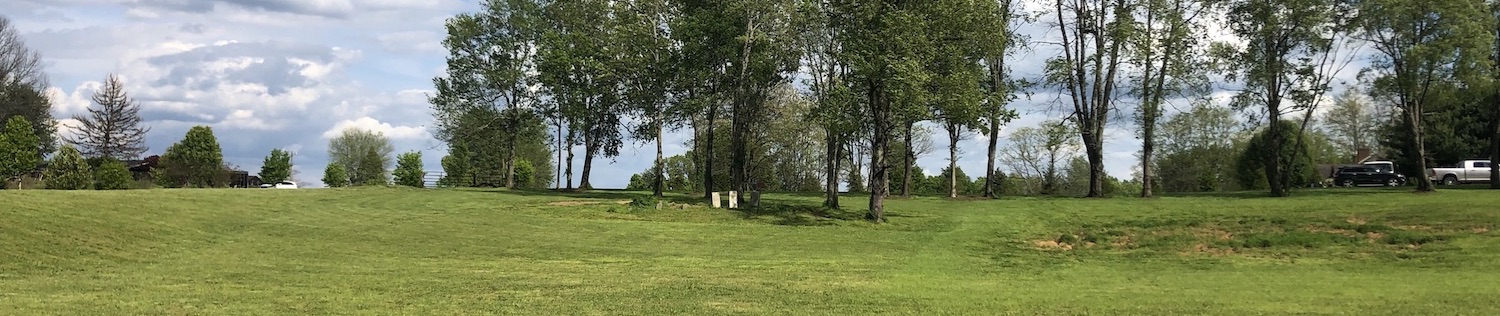
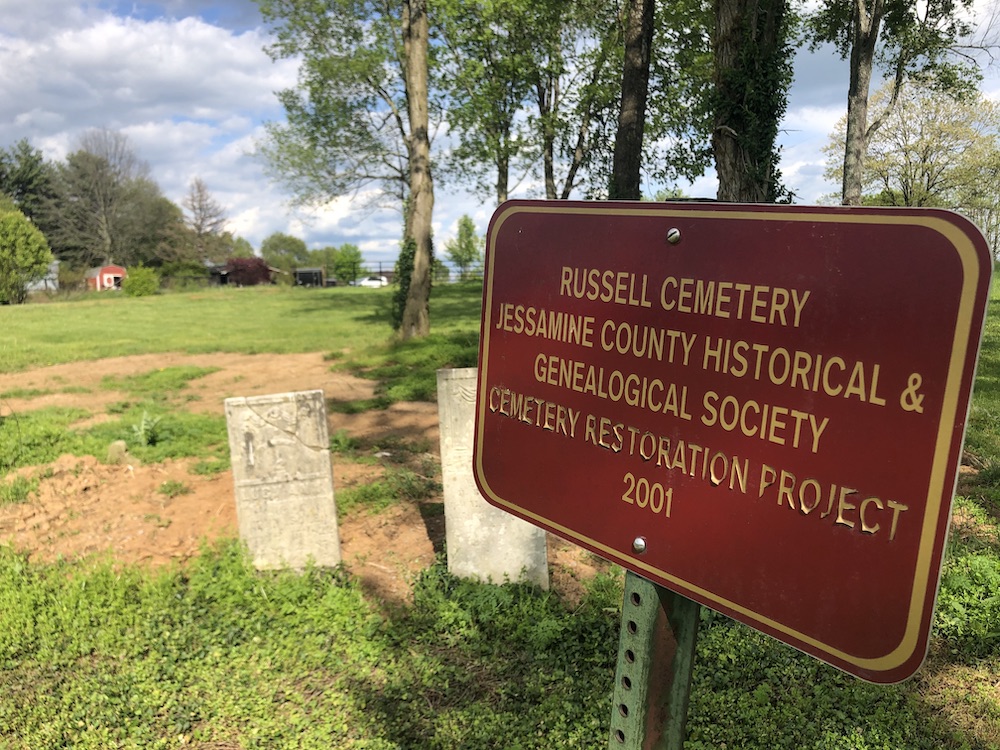
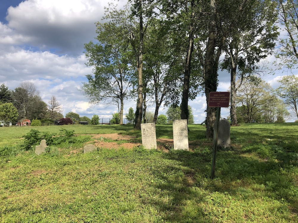
In 2001, the Jessamine County Historical Society helped to restore a historic family cemetery located in the county near the intersection of Highway 68 and KY 169. There are five identified graves in the cemetery according to the Society’s records.
Russell Cemetery. Author’s collection.
The Remains
There are five headstones identified at the Russell Cemetery:
Elizabeth McClanahan PREWITT (Dec. 13, 1787 – June 13, 1833)
Harvey PREWITT (1786 – May 1840)
Elizabeth Featherston RUSSELL, Age 80 years, Wife of Hezekiah (Unk – May 26, 1863)
Hezekiah RUSSELL (April 10, 1790 – October 24, 1872)
Lucy Ann SALE, wife of John (Feb. 15, 1822 – Sept. 2, 1858) [1][4]
The (Short) Backstory
The cemetery near the intersection of the two highways contains not just the Russell family remains, but it is a tangible reminder of history itself.
Russell’s Tavern at Russell’s Cross Roads
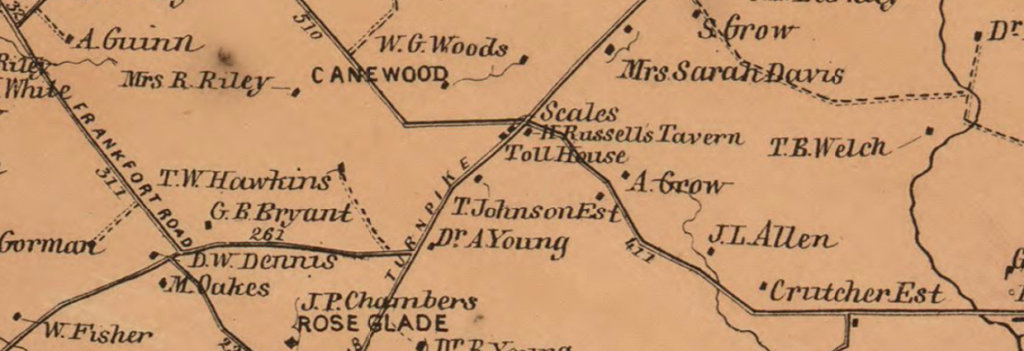
Hewitt’s 1861 Topographical Map. Library of Congress.
The map above shows a busy intersection at the onset of the Civil War. Near H. Russell’s Tavern was a tollhouse and scales where tolls were collected for those passing along the Lexington-Harrodsburg-Perryville Turnpike which was also known as Old Curd’s Road.
H. Russell’s Tavern was, of course, the tavern owned by Hezekiah Russell whose remains were buried at the Russell Cemetery following his 1872 death.
An archeological study conducted in the spring of 1999 uncovered “Hezekiah Russell’s mid-19th-century tavern and scales were also identified.” [2] The crossroads was historically referred to as Russell’s Cross Roads after the tavern.[3]
At some point before his death in 1840, Harvey Prewitt “operated the tavern at Russell’s Cross Roads.” Harvey Prewitt was born in 1786 in Halifax County, Virginia. His first wife, Elizabeth, is buried in the Russell Cemetery; they were wed in 1821. [5]
A Veteran of our Nation’s Independence
Harvey’s father, Byrd Prewitt, served in the Revolution, enlisting in Virginia “as a private in Capt. Henry Terrill’s Company, Col. Josiah Parker’s 5th Regiment.” [5] Byrd Prewitt served at the battles of Brandywine and Germantown. [6]
When he applied for a pension in the latter years of his life, he swore that he was “by occupation a farmer but from old age and infirmity can do but little that his wife is dead and that he now lives with his sons-in-law.” [7]
On July 4, 1794, Byrd attended a celebration at the nearby plantation of Colonel William Price; it was a gathering of veterans in the first celebration of our Nation’s independence to occur west of the Allegheny Mountains. [5]
Russell Cemetery. Author’s collection.
Sources
[1] Russell Cemetery. Rootsweb. [Online] Rootsweb. [Cited: May 7, 2020.]. [2]Society for Historical Archeology. 1999. Current Research. [ed.] Norman F. Barka. SHA Newsletter. 1999, Vol. 32, 3, p. 14. [Online]. [3]Hudson, Karen E. 1999.Canewood Farm, Jessamine County, Kentucky.: National Register of Historic Places, 1999. #99000494. [4] Russell Cemetery. Find A Grave. [Online]. [5]Prewitt, Richard A. Prewitt-Pruitt Records of Virginia. Des Moines: 1996 [Online]. [6]Bunch, Clyde N. 1999. Known Revolutionary War Soldiers of Jessamine County, Kentucky. [Online] January 11, 1999 [7]Prewitt, Byrd. 1828. Pension Application of Byrd Prewitt. [trans.] Will Graves. Southern Campaign American Revolution Pension Statements & Rosters. Lexington : 1828. [Online].
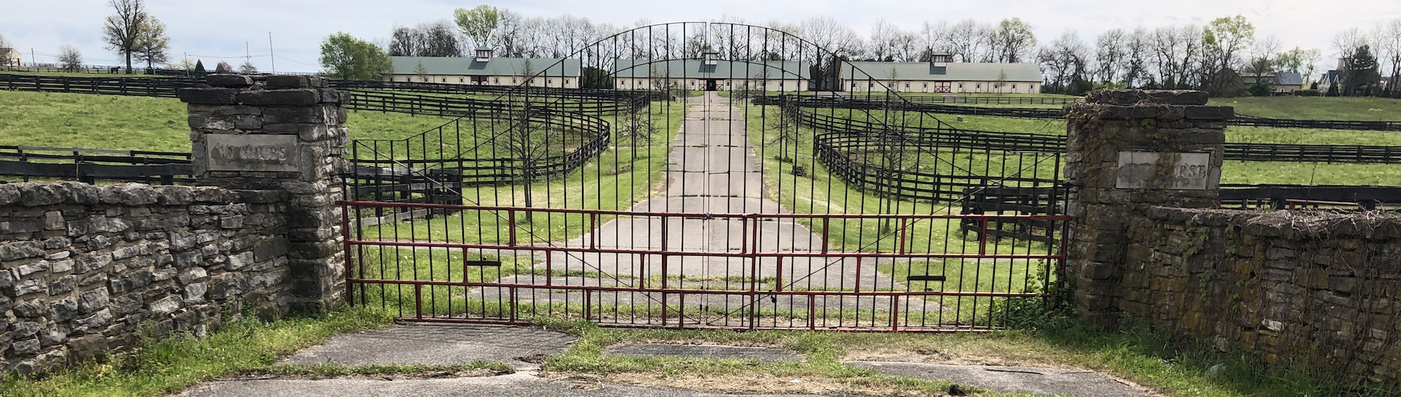
In 2010, a road project in Jessamine County completed the widening of a six-mile stretch of Harrodsburg Road. Before the project was completed, KY-169 didn’t cross Highway 68 at an intersection. Coming from the west toward Nicholasville, KY-169 seemed to dead end at Highway 68 (to continue, you’d turn right and then left to continue on KY-169). At that dead end was a historic marker – # 565 – noting the site of the “Almahurst Farm.”
A Missing Marker
Behind the historic marker was a beautiful stable which remains standing although now much further back from the road. That historic marker, however, seems to have never found its way back to the roadside. The historic marker reads
This is part of the original land granted to James Knight, 1750-1831, for his services in the Revolutionary War. A portion owned by his heirs in 1962. Among the famous horses bred, foaled, and raised on this farm were: Greyhound, world’s champion trotter of all times; Peter Volo, founder of one of the great trotting families; Exterminator, known wherever thoroughbreds are raced.
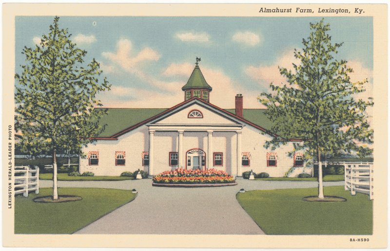
Postcard of Almahurst Farm. University of Kentucky Libraries.
During a recent bike ride along the old US 68 corridor, I thought of the old historic marker as I passed a metal gate between stone columns which bore the name of Almahurst. The Almahurst name, however, might not have been easily seen unless you were looking for the word as some of the letters etched into stone had been patched and filled. But it triggered my memory of that marker which I hadn’t seen in a decade. Another vestige of that old era is that the metal gate and columns are on a stretch of the old highway, just south of KY-169, that today is called Almahurst Lane.
I reached out to the folks at Ramsey Farm, the current property owner.[2] I learned from them that the historic marker remains! It stands at or close to its original location and if you look really closely from the trail, you can make out the marker’s iconic outline. They kindly shared with me this current photo of Historic Marker #565:
Almahurst Farm Historic Marker. Ramsey Farm.
The Knight’s and Exterminator
The original owner of record of the property was James Knight.[1] He received land grants for some 300 acres in 1783 and 1784 for his service during the Revolutionary War in the Continental Army’s Virginia Line. Ultimately, five generations of the Knight family would own the property before it was conveyed beyond the family. Grant Knight, James’ grandson and thus the representative of the third generation of Knights, had three sons: William, F.D. “Dixie,” and Grant Lee.[2] [3] Grant began the family’s equine love affair; his sons built upon the legacy.
Exterminator was the winner of the 1918 Kentucky Derby despite being a long-shot with 30-1 odds. Exterminator was bred by Dixie Knight out of Fair Empress, though the dam was owned by Dixie’s mother.[3] As a result, Dixie may have handled the paperwork on successful horse to his own mother’s discredit.
Knight sold Exterminator for $1,500 in Saratoga’s yearling sales; the buyer was Cal Milam. In the spring of 1918, Milam sold Exterminator to an agent for Willis Sharpe Kilmer. Soon thereafter, Exterminator won the 1918 Kentucky Derby. The gelding’s winning purses exceeded a quarter million dollars.[4] That’s nearly $3.7 million today![3]
Grant Lee Knight’s son, Henry Knight, acquired full ownership of the farm and gave it the name Almahurst. [3] Eventually, the farm ultimately included some 2,100 acres on which both thoroughbreds and standardbreds were raised. Despite its prominence, the Knights never engaged in racing.[3] In time, he would also parcel out portions of the farm to family while liquidating the rest. From the 1960s to the 1990s, P. J. Baugh owned the property and continued to breed standardbreds there.
Ramsey Farm
The property was purchased in 1994 by Kenneth and Sarah Ramsey. They renamed the property Ramsey Farm.
Though they gave the farm a new name, the Ramsey’s have expanded its legacy. Ramsey also owns racing thoroughbreds; according to the Lane Report, “their horses have just short of $95 million in winnings.”[5] They have expanded the property to over 2,000; in 2015, they also acquired the historic Chaumiere des Praries.
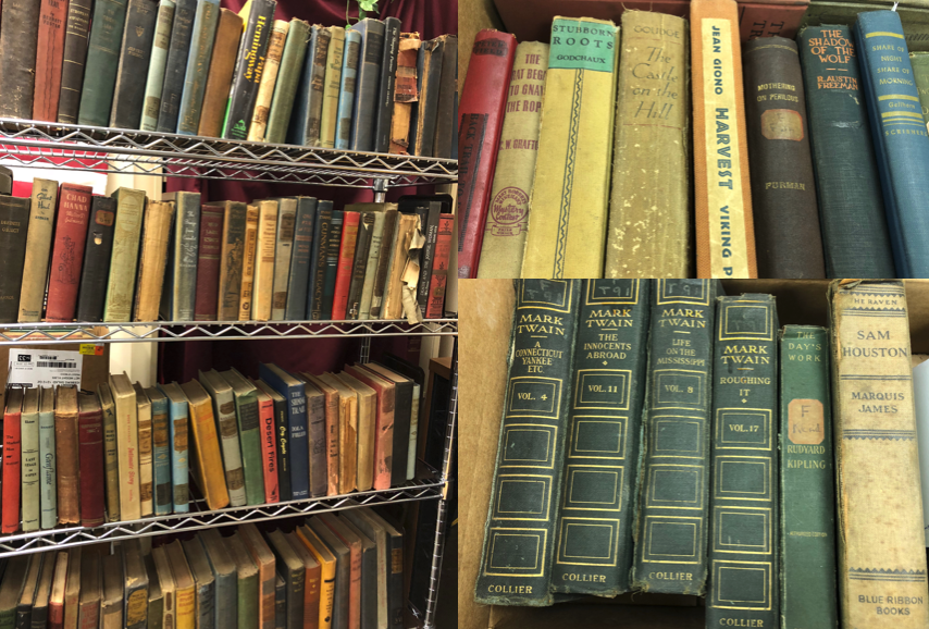
In 1897, Mrs. Sarah Rice Withers bequeathed nearly $33,000 to the Nicholasville Presbyterian Church for the creation of a public circulating library. On the first floor of a building at Maple and First Street, 600 books were moved in. Additional volumes were added to the collection and two employees (a librarian and an assistant) operated the full-time facility.
In 1906, a two-story building (pictured below) was constructed for the library at the corner of Main and Oak streets. Later, the library moved to the corner of Chestnut and Second streets.
At the time of this move, in 1964, the library’s collection was also replaced. The old collection was auctioned and purchased by Swintosky family – a collection of some 3,000 volumes. Since that auction of 54 years ago, the books have remained at the Swintosky residence. Until now.
Sale!
The books that comprised this library collection – including many vintage and antique books – were given to the Jessamine County Historical Society. The Society cannot house this entire collection and is selling the majority of it to raise funds for the society.
The sale will be occurring until Thanksgiving on Saturdays from noon-5:00 pm and Monday-Friday from 5:00-8:00 pm at the Jessamine County Historical Society, 216 N. Main Street, Nicholasville, Kentucky. For the latest updates on sale dates and sale information, please visit the Society’s Facebook event page.
Fairview. Photo dated 1980 by Kenneth Gibbs for the Kentucky Heritage Council (NRHP)
Fairview is located at the corner of Ash Grove and Lexington Roads in Jessamine County. Thanks to the population growth in Nicholasville along U.S. 27, the property is located within the city limits of Nicholasville. And that growth is having a direct impact on Fairview itself.
The History of Fairview
Construction of Fairview, also known on the National Register of Historic Places as the Marshall-Bryan House, began around 1850 by Dr. Lewis Marshall. Dr. Marshall was the younger brother of Chief Justice John Marshall of the United States Supreme Court.
Decades earlier and prior to the Revolutionary War, Alexander McKee had surveyed and claimed this land for himself. In fact, McKee possessed some 3,000 acres in Fincastle County. His allegiance, however, to England during the war resulted in him losing his land holdings. According to historian Walter Hoberg, “an inquest of escheat was held at Lexington by the sheriff of Kentucky county on July 1, 1780, regarding [McKee’s] holdings. They were declared forfeited and were sold for $30,000 at a sheriff’s sale. The money was used in the establishment of Transylvania University.”
It was later that the land on which Fairview was constructed was sold to the Marshall family. Before Fairview would be completed, however, Dr. Lewis Marshall opted to construct a home in Woodford County and the land was sold to the Bryan family and which family would continue to own the property until it was sold in January 2018 to developers.
Fairview in 2018. Author’s collection.
In his newsletter to constituents, Jessamine County Fourth District Magistrate George W. Dean wrote a brief history of Fairview, noting that during the Civil War “the roof of the house was used as an observation point to observe possible troop movements in the area … [and that] enemy troops could be spotted from long distances by clouds of dust created by the movement of large numbers of men and horses, especially during dry weather.”
When the property was added to the National Register of Historic Places in 1984, Fairview was described as “one of the most expressive of the county’s Greek Revival houses [with] design features unusual in the county (full front portico, octagonal entry columns, hipped roof, vertical stacking of features.”
Author’s collection.
The Development
According to Cheryl Truman’s article in the Lexington Herald-Leader, a new development called Greyson on 27 “will include 26 acres of multi-family homes and 33 acres of single-family houses.” It is being developed by Hills Property Management of Cincinnati.
Travelers along the old highway have recognized this home as a landmark for 170 years, but soon the building will be invisible to passing motorists as a 2-story, 14 unit multi-housing apartments building will be constructed between the old home and the highway. Although some lament this loss and it certainly does impact the setting of the historic home, it is laudable that the developers are rehabilitating and incorporating the historic Fairview into their plans. Too often, the dozers that scrape the property would take with it the centuries old brick and mortar. Although the historic property will forever be altered and hidden from plain view, all is not lost.
It is my hope that historic signage will be available so that visitors and residents alike may have the opportunity to pause and consider Fairview’s past.
Portion of Zone Map Amendment, Final Development Plan for Connell Property.
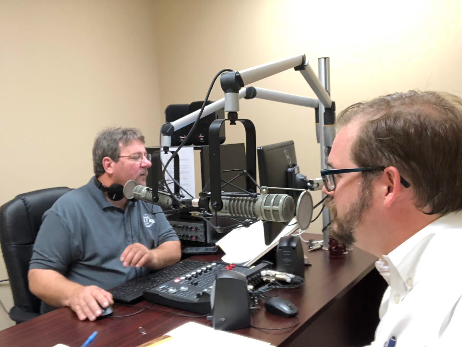
On Monday, June 4, I will be appearing on WTVQ-TV’s Midday Kentuckyto discuss Lost Lexington. Check it out at noon on Channel 36! There may even be a giveaway!
And I spent two Saturdays in May talking with Doug Fain on All Things Jessamine which airs Saturday’s onWNKJ 105.9 in Nicholasville. Doug and I talked about theRev. John Metcalf Houseand theLady Sterling House. You can learn more about the Lady Sterling House by clicking here, too! Click on the links to listen to the podcast if you missed out on those episodes of Jessamine County history!
Doug Fain and Peter Brackney discussing Nicholasville’s history.
To check out Peter’s other past events, click here.