#MovetheMonument

In June 2020, I wrote a post on this site calling for the Fiscal Court of Jessamine County to “Relocate the Jessamine Confederate Monument” though I didn’t organize anything politically.

Around the same time, a local student sought the same thing.

Now, local pastors are urging the removal of the Confederate Soldier’s Monument on the courthouse lawn in downtown Nicholasville to the city-owned Maple Grove Cemetery. This echoes my 2020 suggestion and has an historically sound basis.

The pastors have also created an incredibly well-produced and informative video:

It is time. #MovetheMonument

“Kentucky History & Haunts” Podcast

I was pleasantly surprised to listen to two episodes of the Kentucky History & Haunts podcast this week. The podcast, hosted by Louisvillian Jessie Bartholomew, shares the “history, true crime, and bizarre happenings in … Kentucky, [that] treasure trove of interesting people, events, and places dating as far back as the mastadon!”

Part One of the Podcast

Part Two of the Podcast

Order the Book

If you haven’t read the Geneva Hardman book, I hope you’ll pick up a copy either through this site or via amazon.com.

The Old Schoolhouse Oak

The record-breaking winds of March 3, 2023, caused much destruction throughout central Kentucky; these winds took down a sentinel landmark: the venerable Old Schoolhouse Oak. When I learned of the falling of this tree, I must admit I was greatly saddened because I so frequently admired her.

Possibly five-hundred years old, the Old Schoolhouse Oak began as a mere acorn from which a small seedling grew along a buffalo trace. The Old Schoolhouse Oak began when bison roamed this region centuries before Europeans began to settle here. Native Americans found sustenance along the trace near the Old Schoolhouse Oak which grew on a hill rising above the waters of the South Elkhorn Creek.

Under her boughs, the children of the South Elkhorn schoolhouse played and laughed and made memories. Under her boughs, they undoubtedly grieved the death of one of their own.

Too, the Old Schoolhouse Oak was a contemporary of not just you and I, but also of Christopher Columbus and Martin Luther (some suggest that our particular tree was not quite so old, in which case her named European contemporaries would be different, but there is no doubt that her growth long preceded the United States as a nation).

The Spirit of Trees

And it was Martin Luther who wrote that “God writes the Gospel not in the Bible alone, but also on trees, and in the flowers and clouds and stars.” And in her book Braiding Sweetgrass, Robin Wall Kimmerer, author and member of the Citizen Potawatomi Nation, reminds us of the power of trees to communicate in a language all their own:

In the old times, our elders say, the trees talked to each other. They’d stand in their own council and craft a plan. But scientists decided long ago that plants were deaf and mute, locked in isolation without communication. The possibility of conversation was summarily dismissed. Science pretends to be purely rational, completely neutral, a system of knowledge-making in which the observation is independent of the observer. And yet the conclusion was drawn that plants cannot communicate because they lack the mechanisms that animals use to speak…. But pollen has been carried reliably on the wind for eons, communicated by males to receptive females to make… nuts. If the wind can be trusted with that fecund responsibility, why not with messages?… There is so much we cannot yet understand with our limited human capacity. Tree conversations are still far above our heads.

Robin Wall Kimmerer
The Old Schoolhouse Oak, a once mighty bur oak, the day after she succumbed to forces of nature. Author’s collection.

A Preservation Icon

A decade ago, the Old Schoolhouse Oak was nearly lost to development along the busy Harrodsburg Road corridor. Instead, however, the developers hired arborists to come up with a plan to save the venerable tree. Among those individuals was Dr. Tom Kimmerer who wrote about the Old Schoolhouse Oak in his book, Venerable Trees: History, Biology, and Conservation in the Bluegrass. I met Tom for the first time during the Kentucky Book Fair (back when it was in Frankfort) as his book and my first book, Lost Lexington, were both published around the same time. I also previously reviewed his book, Venerable Trees, on this blog.

In that review, I wrote that “although the preservation of historic buildings has been at times fiercely discussed over the past half-century in Lexington, … the fight over the preservation of historic trees has not drawn the same level of attention. But the preservation of the Old Schoolhouse Oak may be a game changer.”

Before Tom’s involvement, the mighty Old Schoolhouse Oak was not as prominent. Underbrush concealed a bit of its grandeur and the other trees in its council stood nearby. Below is an image and caption from a chapter in Lost Lexington that examined what has been lost in Lexington in terms of greenspace – calling for the preservation of what makes the inner Bluegrass region so unique.

The Old Schoolhouse Oak as it appeared in my first book, Lost Lexington

But, ultimately the Old Schoolhouse Oak has been lost to history. It, too, is a part of lost Lexington. Tom Kimmerer’s prophetic words in Venerable Trees have come true

The best we can do is take the greatest care possible … and allow the tree to live out its natural life. We cannot stop such forces of nature as storms, and this is a very exposed tree.

Tom Kimmerer

No, we cannot stop forces of nature.

Foster Ockerman

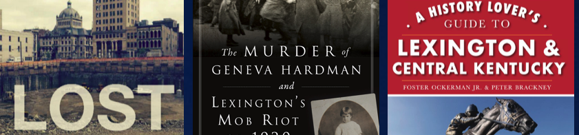
A shared interest in local history led to a friendship full of stories, camaraderie, and memories which I will carry with me. It was a privilege to have co-authored A History Lover’s Guide to Lexington and the Bluegrass Region with Foster.

All those who counted with him are better for it and I am certain his legacy will endure. Above all, my heart mourns with Martina and their daughters.

The Lexington History Museum was a cause near and dear to Foster’s heart. I would encourage readers of this blog to contribute to the Museum’s Foster Ockerman, Jr. Memorial Fund.

Obituary

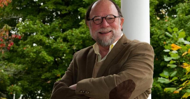
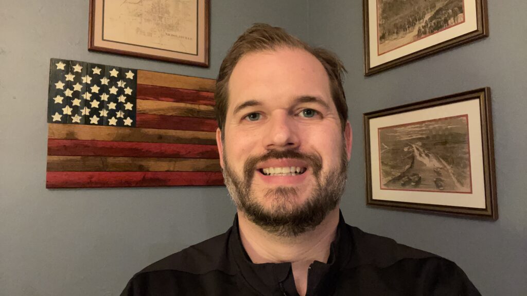
Foster Ockerman, Jr., a Lexington native, seventh-generation Kentuckian, attorney, historian, author, poet, essayist, community leader, and amateur genealogist died December 4, 2022.  He is survived by his beloved wife, Rev. Martina Young Ockerman, and daughters Hannah Ockerman Helsby (Mike) and Katrina Chace Ockerman, his grandchildren, Livy Ruth and Michael Foster Helsby, brother Jeff H. Ockerman, sister Ann Ockerman Baughn (Phil), niece Dr. Elizabeth Hubbard (Matthew) and nephew John Foster Ockerman (Kate). He was preceded in death by his parents, Foster and Joyce Ockerman.       

 As an attorney, Ockerman served his clients for over 40 years, representing clients locally as well as nationally and from 17 foreign countries. He was chairman of the Kentucky Bar Association sections of Real Property and In House Counsel, and an officer of other sections. He was chairman of the American Bar Association’s Tax-Exempt Organizations Committee. He built an extensive practice representing public charities, foundations, and religious entities. In 2018, Ockerman was named Outstanding Citizen Lawyer by the Fayette County Bar Association.  

Ockerman was a founding trustee of the Lexington History Museum, Inc., and served the museum for six years as president, during which time he revived the organization and guided it to a home at the Adam Rankin House, the oldest residence in Lexington. At the time of his death, he was serving as Chief Historian.  

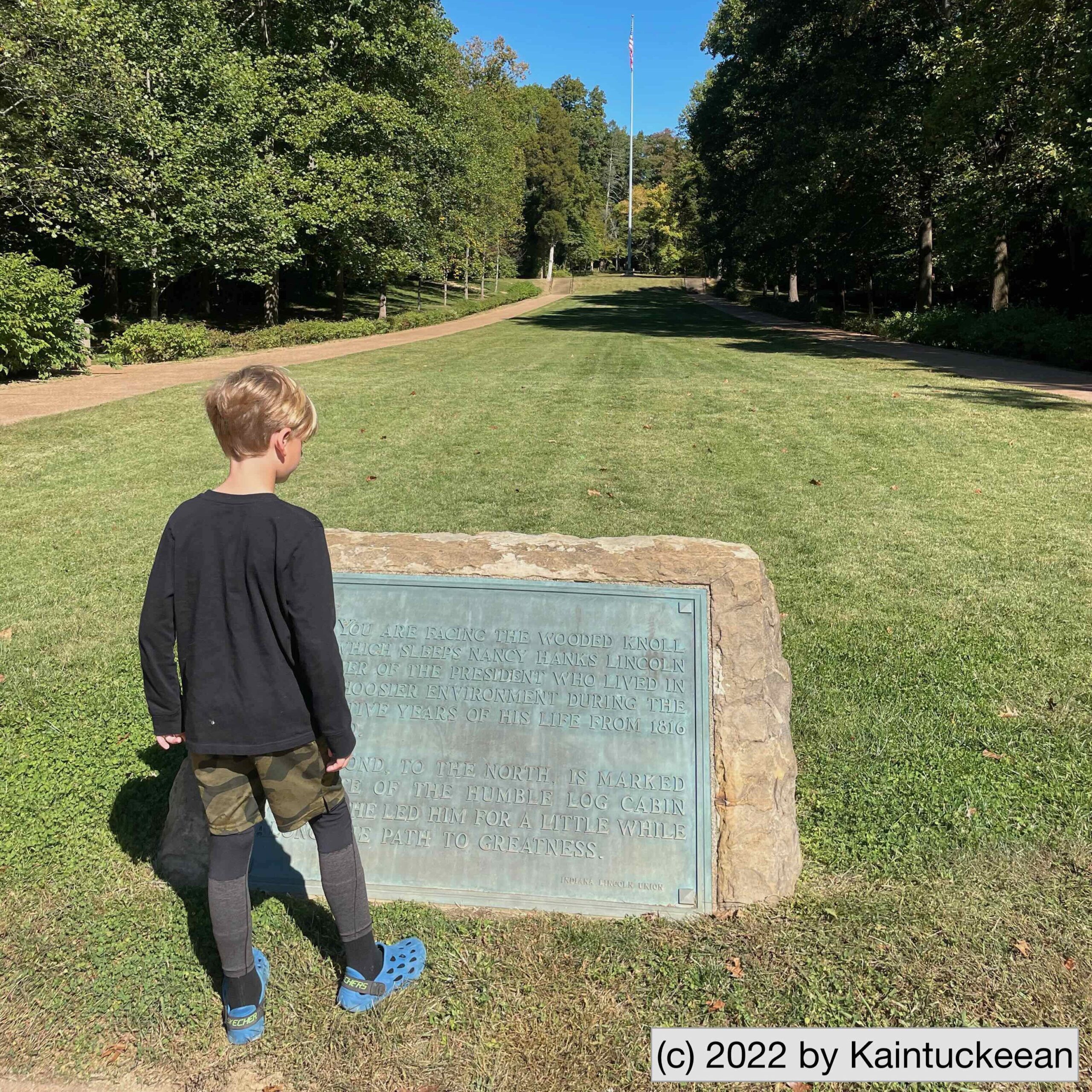
Ockerman first published his poetry and fiction while in high school and continued to publish through his life. Ockerman authored nine works of history, including The New History of Lexington, the most recent history of Lexington, Ky. (2021), an anthology of his poetry and The Ockerman Genealogical Project, as well as numerous opinion essays. His first opinion essay was published while he was in law school on the OpEd page of the Courier Journal. Ockerman also authored the Hidden History of Horse Racing in Kentucky, and co-authored A History Lover’s Guide to Lexington and Central Kentucky. At the time of his death, he was researching and writing Kentucky’s Rocky Road to Statehood. Ockerman was also the historian for the Emmy Awardwinning documentary, Belle Brezing and the Gilded Age of the Bluegrass. Ockerman also hosted for Chronicles, a Kentucky History Magazine documentary.  

Ockerman was a graduate (1970) of Henry Clay High School, where he was Student Body President, named Outstanding Senior Man, second place in state debate and winner of a state speech tournament event and competitor at the National Speech Tournament. At the University of North Carolina, Chapel Hill (1974), he was a campus leader and two term president of the Joint Senate of the Dialectic and Philanthropic Societies. At the University of Kentucky College of Law (1977) he was president of the Moot Court Board.  

Ockerman was a lifelong member of First United Methodist Church, Lexington, where he served as church historian from 1986 to 2022 and was lay leader, chairman of the Administrative Board, founding steward and chairman of the Endowment Foundation, as well as other offices. Ockerman served on the board and executive committee of the General Commission on Archives & History for the (global) United Methodist Church. In the church at large, he held various district offices, was a member and chairman of the Annual Conference Board of Trustees. He authored the First United Methodist Church Bicentennial History and 225 Years of Ministry: The History of First United Methodist Church.  

Visitation will be on Thurs., Dec. 15, 2022, 12 pm to 3 pm, at First United Methodist Church, 200 W. High St., Lexington, KY  40507.  A private service will be held at the Lexington Cemetery.  Donations may be made to the First United Methodist Church or the Lexington History Museum.  

Who’s Always Wanted to go to Lincoln’s Boyhood Home?

A little off the interstate west of Louisville lies the boyhood home of Abraham Lincoln. Lincoln’s birthplace is in Kentucky, but his family relocated to southern Indiana in 1816. At the time, young Abe was about 8 years old.

My own eight year old was asleep when we arrived in the parking lot outside the visitor center. The older two lil’ Kaintuckeeans were disappointed they’d have to endure one of their dad’s historic jaunts, but were willing to placate me in order to make a bathroom pit stop. When he awoke, however, the li’lest Kaintuckeean exclaimed how he’d “always wanted” to come to the Lincoln Boyhood Home. No doubt my grin stretched from ear to ear.

Reading up on history. Author’s collection.

So the answer to who’s always wanted to go to Abraham Lincoln’s boyhood home is: this guy.

As he read the plaque, he also learned that Honest Abe was his own age when his family relocated to this locale. In addition to the visitor’s center, there is a recreated farm homestead, the archaeological site of the original Lincoln homestead, and the cemetery where Nancy Hanks (the President’s mother) is buried.

I will study and get ready, and perhaps my chance will come.

A. Lincoln

Abraham Lincoln remained here for some fourteen years learning many of life’s lessons which he carried with him first to Illinois and then to our nation’s capitol.

Historic site of the Boyhood Home. Author’s collection.

Restore the Historic Markers

Previous Historic Marker at Hopemont in Lexington, Kentucky. WUKY.

In a column for the Jessamine Journal in 2015, I wrote about how historic markers shared Kentucky’s history. That 2015 column convoluted the Historic Markers Society and the current historic markers program in Kentucky when, in reality, the former evolved into the latter. A shortcut was made for the sake of brevity.

But the full history is being properly told this week at a legislative committee (Interim Joint Committee Tourism, Small Business, and Information Technology) which is hearing testimony on the need to restore and rehabilitate historic markers which have gone missing or are in need of repair.

In 1935, some businessmen from central Kentucky discussed an effort of “marketing the bluegrass” by “starting a movement” to promote historic places around the Bluegrass. this Historic Markers Society wanted to install 100 historic markers, though it fell short by delivering only 21. Ultimately, the historic markers program fell until state control and the effort was made to utilize these roadside markers to share Kentucky’s history statewide.

Unveiling by Foster & Brenda Pettit of the new Historic Marker #3 (#2365) at Hopemont in 2012. Author.

Many of the original 21 markers are in desperate need of repair, though some have already been repaired. Through that process, a more complete history can also be told (modern technique allows more text and context. To illustrate, compare the two photographs above of the marker outside Hopemont in Lexington; work to restore and update this marker was paid for by a non-profit organization.

Since 1935, joint federal and state efforts have sought to “preserve for public use historic sites, buildings and objects of national significance.” In 1966, the National Preservation Act strengthened this mission. The sites identified through the historic marker program truly tell Kentucky’s story through over 2,400 unique markers. You can explore them by clicking here. And you can support their repair and upkeep by encouraging your legislators to take up the cause of a line-item in the state budget for the preservation of these markers.

The hearing of the Interim Joint Committee will meet on Tuesday, July 27, at 1pm. Testifying will be Scott Alvey (Executive Director Kentucky Historical Society), Kurt Krouse (Chair, St. Paul Parish Historical Preservation Ministry), and Foster Ockerman Jr., JD (President and Chief Historian Lexington History Museum). Although the legislature is only hearing testimony at this time, it is our fervent hope that funding will be found so that Kentucky’s rich history can continue to be told through these historic markers.

When the Waters Rise

Depending on the region of Kentucky in which you leave, the concept of a flood differs entirely. To the western Kentuckian accustomed to acres upon acres of flat cropland near the Ohio River, rising waters inundate the soil. And while damaging, there is little surprising when rainfall and upstream gauges indicate what is to come. At the opposite end of the spectrum are the hollow valleys in eastern Kentucky where a flash flood can wash out all a family knows in a matter of second. There is no warning. Central Kentucky lies somewhere in between. Regardless of how the floodwaters impact you or your region, when the waters rise they can cause tremendous damage. To livelihoods, to buildings, to towns, and to the land itself.

I have hiked Asbury Trails a few times so far in 2021. There was torrential rain on February 28, 2021, which led to significant flooding along the Kentucky River. I mean, significant. In the fall of 2020, the kids and I tossed rocks into the river from a rocky beach at the base of the Wilmore water intake. It’s been awhile since I’ve seen much of that little beach.

The water intake pumps were constructed in 1973 by Asbury University (nee College) before being transferred to Wilmore in 1977. In the picture below, you can see the intake pump near the center of the photograph. If you are familiar with these trails, you might notice immediately that the walking bridge is not in this focus as it is entirely submerged. Yeah.

Waterlogged Asbury Trails on March 5, 2021. Author’s collection.

For a closer look at the water intake – and for comparison for how things should look, I offer the following photograph from March 27, 2021:

Wilmore Water Intake at the Kentucky River, March 27, 2021. Author’s collection.

The red line indicates the high water mark that I personally observed earlier in March. From a different before-after perspective, the photograph immediately below is from early February 2021. The rock and leaf covered creekbed runs through the center of Asbury Trails. The second photograph shows the destruction caused from the late February rains. Remember that in both pictures, I am standing on a bridge that was completely submerged during the days of the rising waters.

Pre-flood from the Asbury Trails bridge, 5 February 2021. Author’s collection.
Post-flood, from the Asbury Trails bridge, 27 March 2021. Author’s collection.

You can also see a new rut being created as the land evolves and the fresh rainwaters of March 2021 find their way to the Kentucky River. One final photograph of the land’s evolution is below showing the soil erosion adjacent to the trail as it runs alongside the river toward the spring, cave, and waterfall. Across the river, additional erosion was also visible.

Erosion visible on 27 March 2021 along the Kentucky River following late February/early March floods. Author’s collection.

Jessamine Creek Gorge Trail

Overstreet Creek Bridge on the Jessamine Creek Gorge Trail. Author’s collection.

For several years I have heard about the beautiful Jessamine Creek Gorge that cuts through central Jessamine County on its way to the Kentucky River. Part of the Kentucky River Palisades region, rocks exposed along this tributary are also magnificent.

Strong rains had fallen during midweek through Thursday, so a Friday morning hike seemed like the optimal time to explore this resource so close to Lexington. Adding to the enjoyment was the late winter date as some have commented that the trail becomes both overcrowded and overgrown later in the season. I dealt with neither, however, and thus had a splendid experience. The flora later in the season is also said to spectacular, so it may be another example of beauty being in the eye of the beholder.

Jessamine Creek Trail Entrance. Author’s collection.

Before saying more, I ought to reiterate this word of caution from the Jessamine County Trails Association:

Jessamine Creek Gorge is an ecologically sensitive area.  Please observe local ordinances and park rules. Stay on the marked trail. No trespassing onto neighboring properties. Don’t leave trash in the preserve.  There is a trash can at the parking lot. Park in the parking lot. Do not park anywhere along the road other than the parking lot. Ignoring the rules may result in the preserve being closed to visitors by Jessamine County Fiscal Court.

The trail itself is a little politically sensitive so following these rules is über-critical. Like staying on marked trails: yes, there’s an amazing 76-foot waterfall on Overstreet Creek. No, you can’t see it from the trail. Deal with it. There’s plenty more beauty to enjoy.

Jessamine’s Etymology

Jessamine County was carved from Fayette County in 1798. It was named after a flower that grew along the banks of the creek which already bore the name from an Indian tongue. Other accounts suggest that the county was named after the daughter of a settler, Jessamine, was scalped near the site. The naming of Jessamine County is unique under either story as it traditionally considered the only Kentucky county with a feminine name.

Under either account, the creek and the county around it are beautiful. These words appeared in the Lexington Leader on May 31, 1897: “Jessamine Creek is one of the most beautiful streams in Kentucky. It is not the unusually beautiful scenery along the banks of the creek, or its soft, clear limestone water which makes it an object of so much interest; but the stories of the many sad tragedies which have been enacted along its banks and in its waters.”

Dam Jessamine Creek?

In an attempt to control massive flooding along the Kentucky River, a proposal during the 1940s and 1950s would have seen a 148-foot tall dam constructed along the Kentucky River near the mouth of Jessamine Creek. According to a publication by the Army Corp of Engineers, Engineering the Kentucky River: The Commonwealth’s Waterway, such a construction project would have “submerged 21,500 acres of the Kentucky valley and ended navigation of the river upstream of Lock No. 7.”

Preservationists and others decried the project and it thus never received Congressional funding and never was constructed. Instead, levees and floodwalls were utilized to protect the Capital City (which was the main purpose for the proposal). Although the Jessamine Creek Dam project was first initiated in the early 1940s, it was finally killed in 1962. The timeline mirrored Frankfort’s Craw neighborhood.

A Beautiful Hike

It is said that a picture is worth a thousand words. When it comes to these hikes, I’d argue that a short video is worth a thousand pictures. Enjoy and please share your experiences of hiking at Jessamine Creek Gorge in the comments!

Speaking Engagements?

After Lost Lexington was published in 2014, one of my favorite things to do was to go out and speak at libraries or to church groups and civic groups. Book signings were such a fun way to share the backstories of Lexington’s lost places. Here’s a list of my past events!

But when I planned two books for release in 2020, I had no idea that a worldwide pandemic would bring any author talks to a screeching halt! I only could say that refrain which we all uttered countless times over the past twelve months: It is what it is.

Now, these kinds of groups are again meeting in person (in socially distanced ways) and others are meeting online utilizing technology with which we’ve all become so familiar. Would your civic group or organization be interested in having me speak about one of my books? I am available for both virtual and in-person events to discuss any of my three books:

Quiet trails near Wilmore

Wildflowers along the trail. Author’s collection.

Beyond Wilmore lies a quiet country road from which you can find the Asbury Trails which are owned by Asbury University. These trails overlook the Palisades and descend to the Kentucky River. Because of their proximity to Lexington, they are trails which I tend to frequent.

Asbury Trails are so close to Lexington, yet a world apart. As Lexington has grown, it is more and more difficult to find accessible natural locations where you can rejuvenate the mind, body, and spirit. Raven Run and McConnell Springs are both good locations in Fayette County, but there are many more great hiking locations in central Kentucky especially along the banks and bluffs on either side of the Kentucky River.

The Kentucky River Palisades rise some 400 feet on either side of the Kentucky River in what geologists call an entrenched meander. According to the trails brochure, “about ten million years ago the Bluegrass was a flat, low lying area. The Kentucky river slowly wound across a wide plan. Then eastern America experienced a broad uplift, raising this area 400 feet [and the] river began cutting into the uplifted plateau.” Silt build up at bends in the river also led to the formation of landings, many of which became crossings for buffalo and later settlers (and even later, bridges) over or through the water.

At the river, the Asbury Trails reach one such location. The small, rocky beach is adjacent to the city of Wilmore’s water intake tower which draws up 2 million gallons per day for the city’s water usage.

The Kentucky River at Asbury Trails. Author’s collection.

According to the Jessamine County Kentucky River Task Force, “toll roads were privately built for profit (if any) in conjunction with specific ferries. The Fulkerson Ferry was chartered at this site in 1789 and was in use when a toll road was built in the mid-1800’s for travel between Lexington, Harrodsburg, and the Shaker community at Pleasant Hill in Mercer County. Prior to its use as a stage crossing, it was a major buffalo crossing at the shallow sand bar here.” On the Mercer County side of the river,

Stage coach houses were built on both sides of the river to accommodate travelers and horses. Known stage lines using this crossing were The Smith Stage Coach Line and the Lexington-Harrodsburg Line.

Waterfall along the Asbury Trails. Author’s collection.

The trails consist of a half-mile Hillside Trail which follows along the top of the bluff ending in a meadow after passing through woods and across the ravine. The Old Stage Road Trail, three-quarter miles in length, descends 350 feet from the bluff along one side of the ravine toward the river. A bridge at the end of the trail cuts over to the old crossing and the intake tower. A gravel road descends on the opposite side of the ravine to complete the loop.

At the end of the Old Stage Road Trail is the beginning of a quarter-mile Great Wall Trail which gives the best vista of the rock formations that make up the Palisades. (The trail actually continues more than the 0.25 miles, but the “unofficial” trail extends beyond Asbury’s property line.)

These short trails are beautiful and worth visiting.

A short montage of photographs from a recent winter visit to Asbury Trails.

Resources

Asbury Trails, Official Site
Jessamine County Trails Association
Kentucky River Guidebook