Jessamine Creek Gorge Trail

Overstreet Creek Bridge on the Jessamine Creek Gorge Trail. Author’s collection.

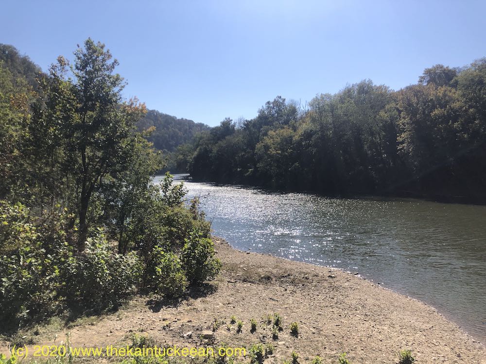
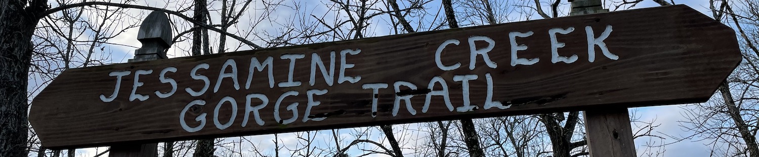
For several years I have heard about the beautiful Jessamine Creek Gorge that cuts through central Jessamine County on its way to the Kentucky River. Part of the Kentucky River Palisades region, rocks exposed along this tributary are also magnificent.

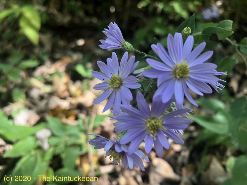
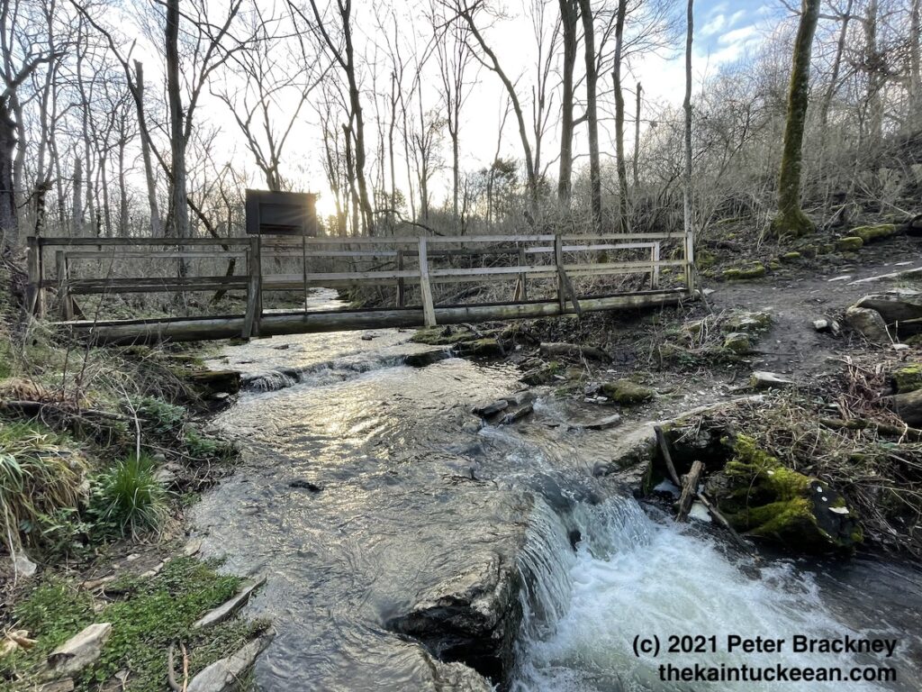
Strong rains had fallen during midweek through Thursday, so a Friday morning hike seemed like the optimal time to explore this resource so close to Lexington. Adding to the enjoyment was the late winter date as some have commented that the trail becomes both overcrowded and overgrown later in the season. I dealt with neither, however, and thus had a splendid experience. The flora later in the season is also said to spectacular, so it may be another example of beauty being in the eye of the beholder.

Jessamine Creek Trail Entrance. Author’s collection.

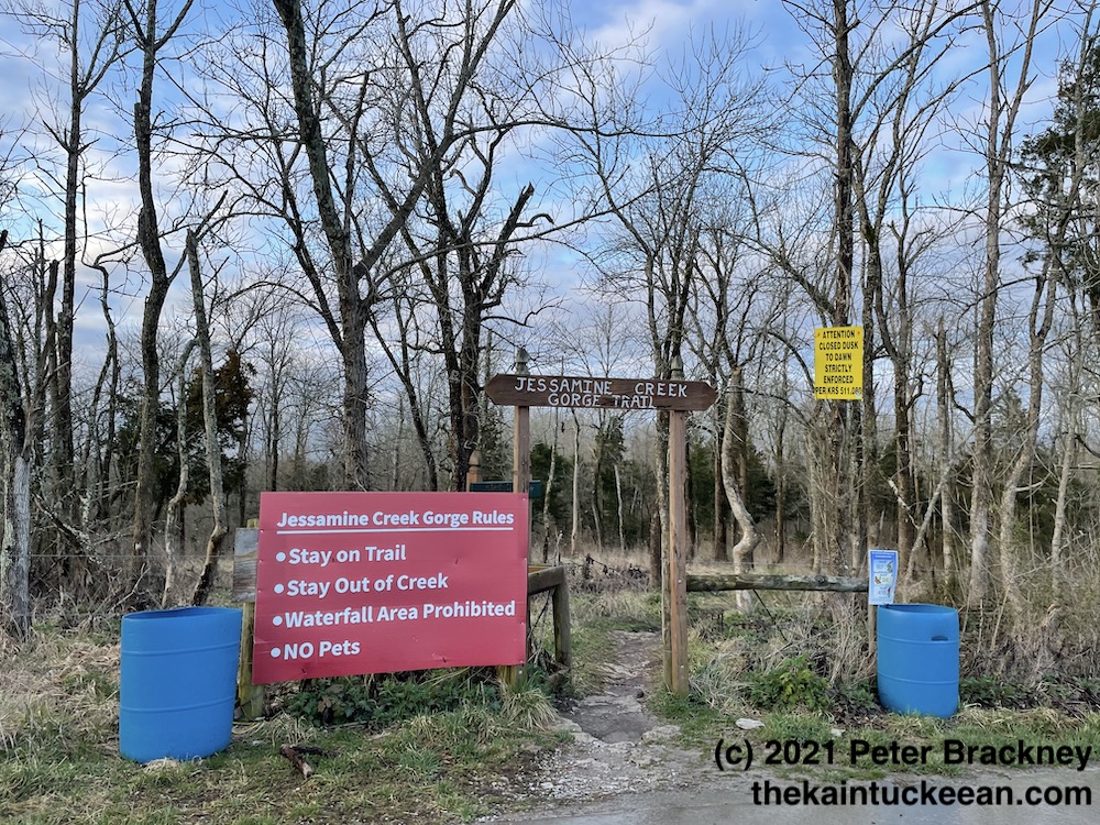
Before saying more, I ought to reiterate this word of caution from the Jessamine County Trails Association:

Jessamine Creek Gorge is an ecologically sensitive area.  Please observe local ordinances and park rules. Stay on the marked trail. No trespassing onto neighboring properties. Don’t leave trash in the preserve.  There is a trash can at the parking lot. Park in the parking lot. Do not park anywhere along the road other than the parking lot. Ignoring the rules may result in the preserve being closed to visitors by Jessamine County Fiscal Court.

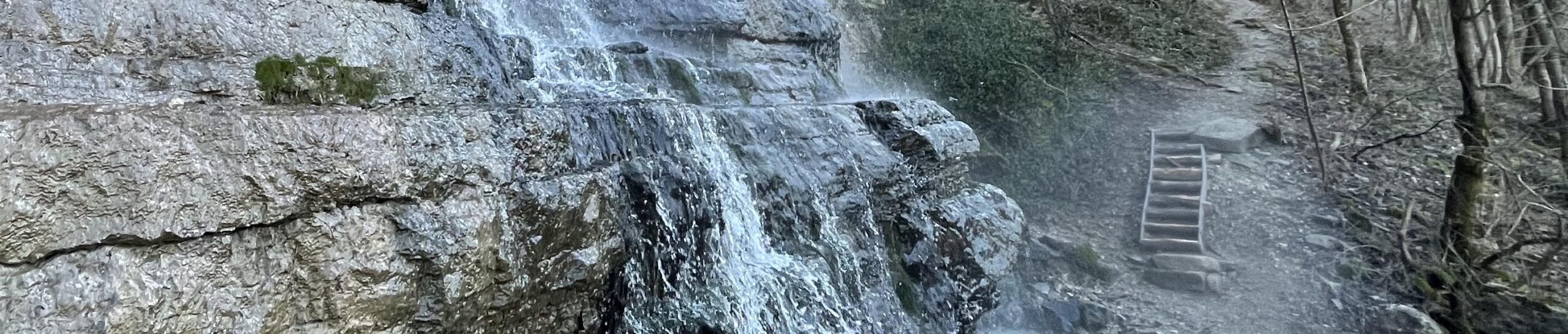
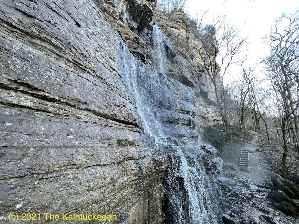
The trail itself is a little politically sensitive so following these rules is über-critical. Like staying on marked trails: yes, there’s an amazing 76-foot waterfall on Overstreet Creek. No, you can’t see it from the trail. Deal with it. There’s plenty more beauty to enjoy.

Jessamine’s Etymology

Jessamine County was carved from Fayette County in 1798. It was named after a flower that grew along the banks of the creek which already bore the name from an Indian tongue. Other accounts suggest that the county was named after the daughter of a settler, Jessamine, was scalped near the site. The naming of Jessamine County is unique under either story as it traditionally considered the only Kentucky county with a feminine name.

Under either account, the creek and the county around it are beautiful. These words appeared in the Lexington Leader on May 31, 1897: “Jessamine Creek is one of the most beautiful streams in Kentucky. It is not the unusually beautiful scenery along the banks of the creek, or its soft, clear limestone water which makes it an object of so much interest; but the stories of the many sad tragedies which have been enacted along its banks and in its waters.”

Dam Jessamine Creek?

In an attempt to control massive flooding along the Kentucky River, a proposal during the 1940s and 1950s would have seen a 148-foot tall dam constructed along the Kentucky River near the mouth of Jessamine Creek. According to a publication by the Army Corp of Engineers, Engineering the Kentucky River: The Commonwealth’s Waterway, such a construction project would have “submerged 21,500 acres of the Kentucky valley and ended navigation of the river upstream of Lock No. 7.”

Preservationists and others decried the project and it thus never received Congressional funding and never was constructed. Instead, levees and floodwalls were utilized to protect the Capital City (which was the main purpose for the proposal). Although the Jessamine Creek Dam project was first initiated in the early 1940s, it was finally killed in 1962. The timeline mirrored Frankfort’s Craw neighborhood.

A Beautiful Hike

It is said that a picture is worth a thousand words. When it comes to these hikes, I’d argue that a short video is worth a thousand pictures. Enjoy and please share your experiences of hiking at Jessamine Creek Gorge in the comments!

Quiet trails near Wilmore

Wildflowers along the trail. Author’s collection.

Beyond Wilmore lies a quiet country road from which you can find the Asbury Trails which are owned by Asbury University. These trails overlook the Palisades and descend to the Kentucky River. Because of their proximity to Lexington, they are trails which I tend to frequent.

Asbury Trails are so close to Lexington, yet a world apart. As Lexington has grown, it is more and more difficult to find accessible natural locations where you can rejuvenate the mind, body, and spirit. Raven Run and McConnell Springs are both good locations in Fayette County, but there are many more great hiking locations in central Kentucky especially along the banks and bluffs on either side of the Kentucky River.

The Kentucky River Palisades rise some 400 feet on either side of the Kentucky River in what geologists call an entrenched meander. According to the trails brochure, “about ten million years ago the Bluegrass was a flat, low lying area. The Kentucky river slowly wound across a wide plan. Then eastern America experienced a broad uplift, raising this area 400 feet [and the] river began cutting into the uplifted plateau.” Silt build up at bends in the river also led to the formation of landings, many of which became crossings for buffalo and later settlers (and even later, bridges) over or through the water.

At the river, the Asbury Trails reach one such location. The small, rocky beach is adjacent to the city of Wilmore’s water intake tower which draws up 2 million gallons per day for the city’s water usage.

The Kentucky River at Asbury Trails. Author’s collection.

According to the Jessamine County Kentucky River Task Force, “toll roads were privately built for profit (if any) in conjunction with specific ferries. The Fulkerson Ferry was chartered at this site in 1789 and was in use when a toll road was built in the mid-1800’s for travel between Lexington, Harrodsburg, and the Shaker community at Pleasant Hill in Mercer County. Prior to its use as a stage crossing, it was a major buffalo crossing at the shallow sand bar here.” On the Mercer County side of the river,

Stage coach houses were built on both sides of the river to accommodate travelers and horses. Known stage lines using this crossing were The Smith Stage Coach Line and the Lexington-Harrodsburg Line.

Waterfall along the Asbury Trails. Author’s collection.

The trails consist of a half-mile Hillside Trail which follows along the top of the bluff ending in a meadow after passing through woods and across the ravine. The Old Stage Road Trail, three-quarter miles in length, descends 350 feet from the bluff along one side of the ravine toward the river. A bridge at the end of the trail cuts over to the old crossing and the intake tower. A gravel road descends on the opposite side of the ravine to complete the loop.

At the end of the Old Stage Road Trail is the beginning of a quarter-mile Great Wall Trail which gives the best vista of the rock formations that make up the Palisades. (The trail actually continues more than the 0.25 miles, but the “unofficial” trail extends beyond Asbury’s property line.)

These short trails are beautiful and worth visiting.

A short montage of photographs from a recent winter visit to Asbury Trails.

Resources

Asbury Trails, Official Site
Jessamine County Trails Association
Kentucky River Guidebook

Bernheim Forest

Until last October, I’d never visited Bernheim Forest. Waiting so long was a mistake. For the uninitiated, Bernheim – officially Bernheim Arboretum and Research Forest – includes 16,137 acres of land in Clermont, Kentucky. It is located about 25 miles south of Louisville on land acquired by Isaac W. Bernheim in 1929.

The History of Bernheim Forest

Isaac and his wife, Amanda, had dreamed of creating an herbarium and arboretum. Amanda died in 1922, but Isaac carried out their shared vision. Isaac Wolfe Bernheim was born in Germany and immigrated to the United States. He arrived in this country with less than four dollars in his pocket and the dream of opportunity. The year was 1867, but he did not immediately find the success he had dreamt for. His uncle was not able to provide him with the work he had planned in New York. Isaac headed west as a peddler throughout Pennsylvania before landing in Paducah, Kentucky in 1868. There, he entered the wholesale liquor business as a bookkeeper.

New York in 1867. Library of Congress.

In Paducah, Isaac Bernheim saved enough money to send home to Germany funds necessary for the emigration of his brother. Together, they opened Bernheim Brothers in 1872. Ultimately, a successor company relocated to Louisville in 1888. The company continued to grow and prosper; it did not shudder during Prohibition. With one of only ten licenses to produce bourbon for “medicinal purposes, Bernheim Brothers remained opened during The Great Experiment of 1920 to 1933.

During this season, Bernheim’s wife passed away and the land for the Forest was purchased. Frederick Law Olmstead began to design the park in 1931 on land that had been strip-mined of iron ore. The park opened in 1950.

To all I send the invitation to come from city, village, hamlet and farm, to re-create their lives in the enjoyment of nature and the many blessings she gives…

I. W. Bernheim

Giants in the Forest

Forest Giant Little Nis at Bernheim Forest. Photo by Peter Brackney.

When I visited with my wife and three kids, we mainly arrived to see the Forest Giants. The Giants were constructed by a Danish artist, Thomas Dambo, using locally sourced recycled wood. The Giants are a family: Mama Loumari and her two children, Little Nis and Little Elinsa. Mama Loumari is depicted as pregnant with a third baby Giant in utero.

The Giants were introduced to Bernheim Forest in celebration of the 90th anniversary of Bernheim’s original land acquisition. You can view all of them in a relatively short walk/hike leaving much of Bernheim Forest unexplored. In total, there are some 40 miles of trails.

Since March 26, 2020, Bernheim has been closed due to the Coronavirus. Once it reopens, it will again be a fantastic place to socially distance. To learn more about Bernheim Forest, its reopening, and how you can support this important part of Kentucky’s greenspace, visit its website www.bernheim.org.