Changes at Tom Dorman

I first visited Tom Dorman State Nature Preserve (SNP) in 2009, discovering the nearby retreat on a day when Raven Run in Fayette County was closed. Since I first visited over a decade ago, the SNP has grown to over 900 acres to become “one of the largest natural areas in the region.” Exposed on its trails are wonderful vistas of the Kentucky River Palisades as well as many rare species, caves, and rocky cliffs.

The cliffs of the palisades some 220 feet over the Kentucky River with mosaic coloring dominate. The cliffs were cut through the limestone rock by the river between 400,000 and 1 million years ago.

Hiking along the trails at Tom Dorman SNP in 2018. Author’s collection.

An old stage coach route through the forest serves as the basis for the main trail which is a “moderately strenuous two-mile loop.” There is a half-mile spur which provides views of the river gorge and another short loop goes down to the banks of the river.

Changes Coming

But for those of us who enjoy visiting Tom Dorman, there are a few changes to note. A new parking lot is accessible directly off US 27 making Tom Dorman SNP much more accessible (and likely busier). Effective March 1, 2020, the old parking lot will be permanently closed. See the image below.

From the map, it is unclear how long the trail is from the new parking lot to the old two-mile loop. It appears, though, that the trail mileage at Tom Dorman SNP has dramatically increased. It’s time to go on another hike!

A friend of mine snapped this picture yesterday at Tom Dorman down by the Kentucky River.
Bryan Campbell.

Historic Markers Share Kentucky’s History

New Historic Marker in Jessamine County. Rep. Russ Meyer.

Throughout Kentucky, roadside markers placed by the Kentucky Transportation Cabinet and the Kentucky Historical Society signify important historical sites. Approximately 2,450 of these markers have been placed at locations around Kentucky since 1949.

The first such historic marker, Ashland, is located in Lexington at the home of Henry Clay. Earlier markers had limited text compared to the lengthier modern markers, though the overall dimensions of the signs have not changed.

Over the last weekend in May, three new historic markers were placed at locales in Madison, Garrard and Jessamine counties. Each of these markers focused on the role of transportation during the American Civil War.

The Madison County marker recognized the decisive Confederate victory at the Battle of Richmond in August 1862 along the old state road, which was a major transportation route for moving Rebel troops.

In Garrard County, the new historic marker noted the movement of firearms authorized by President Abraham Lincoln to Camp Dick Robinson in the early years of the Civil War. There, regiments of Tennesseans loyal to the Union cause were enlisted.

Camp Nelson National Cemetery. Author’s collection.

The latest Jessamine County marker, marker number 2448, is the 19th marker to be located in Jessamine County. Many of these, including the latest addition, are located in and around Camp Nelson.

Marker 2448 reads in part, “When Camp Nelson was established in 1863, impressed slaves from local farms provided much of the labor to construct the earthen fortifications & improve the roads that brought men & materials to this supply base. The following year, when blacks were finally allowed to enlist, many of the former laborers became soldiers who trained at Camp Nelson.”

The African American enlistees served valiantly, often leaving behind their families in peril. Though many family members sought refuge at Camp Nelson, their encampment was only temporary, as they were eventually turned away during the cold winter of 1864. Nearly a quarter of the women and children forced to leave Camp Nelson perished.

In 1866, Camp Nelson National Cemetery was established and the site was added as a National Historic Landmark two years ago. There is no higher recognition that a site can receive, except designation as a National Park. An effort exists to turn Camp Nelson into a National Park, a move that would have major economic benefits for the county and region.

The addition of another roadside marker only serves to continue to tell the story of Camp Nelson’s importance to our local, state and national history.

And, as evidenced by the sheer number of historical markers around the commonwealth, there’s a lot of history to be told. There are new markers placed every year that tell even more of our shared history.

So go out and explore the history around you!

The post above was originally published in the Jessamine Journal on June 4, 2015.  

Hiking Fun for All Ages at Garrard County’s Dupree Nature Preserve

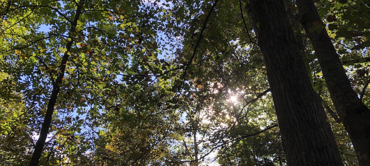
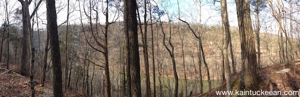
Panoramic View from the Overlook at Dupree Preserve. Author’s collection
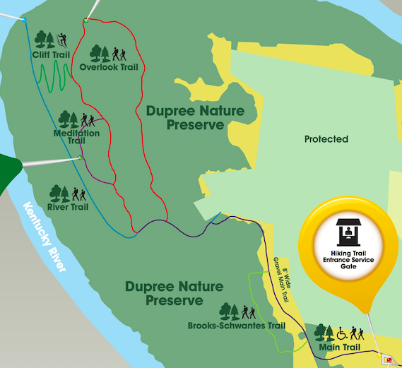
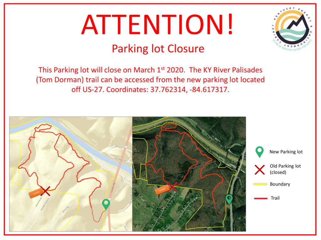
Map of the Dupree Preserve. Preserve.

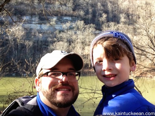
Twice over as many months I’ve taken my two kids, ages 3 and 6, for a hike in the woods. There are few activities that are more fun with kids. Hiking removes them from “screen time” and, under these circumstances, they are happy for the break! They are exposed to nature and my inquisitive 6 year old loves to learn, so I relish the opportunity to take him to such an “outdoor classroom.”

One of central Kentucky’s newest nature preserves and hiking trail opportunities exists in Garrard County at the Dupree Nature Preserve. The preserve opened in October 2013 with the last of the trails, the Cliff Trail, being completed in August 2014. Its 300 acres features savannah, woodlands, views of the Kentucky River and the Palisades, and interpretive materials along the 5-miles of trails.

A Variety of Trails

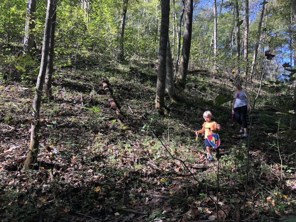
The kids, ages 6 and 3, walking the trails at Dupree Preserve. Author’s collection.

None of the trails at Dupree Nature Preserve are truly difficult. The most challenging is the Cliff Trail which involves a number of switchbacks. In the fallen leaves, it is also the most difficult to follow. It was navigated successfully by the Lil Kaintuckeean and I (I carried 3-year old Lil Miss Kaintuckeean). Fortunately, we were descending the trail which covers a quarter mile in distance and a descent of 140 feet!

The trails begin from the gravel parking lot along a wide gravel path, through savannah grasses which once were the norm in central Kentucky. Paths diverge once you enter the woods, but the two main paths off of the main trail are the River Trail and the Overlook Trail.

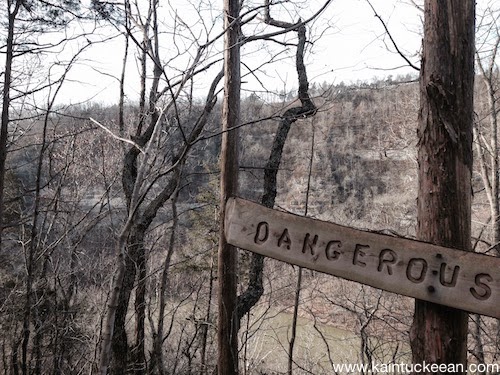
At Dupree Preserve’s Overlook, a sign warns of “Dangerous Cliffs.” Author’s collection

We’ve completed the Overlook Trail twice and it is an easy trail to walk. I’ve seen others comment that a day at Dupree is more like a walk in the park than a serious hike; this is really true except that it works when you are outnumbered by children!

The view at the Overlook is far more impressive than the one at Raven Run simply because of its panoramic scale, though the perspective does lack the curve in the river which dominates the view at Raven Run. Signs warn of “Dangerous Cliffs,” but both a bench and picnic table allow for enjoyment of the beauty at a safe distance.

The Lil’ Kaintuckeean and I at the bottom of the River Trail next to the Kentucky River.
Author’s collection

The long River Trail once served as a River Road from the crossing at river elevation where a ferry once operated at the end of the 1700s. According to the Kentucky River Guidebook, William Smith established a ferry on 200 acres he acquired in Garrard County “across from the mouth of Jessamine Creek.” Much of this land became what is today the Dupree Nature Preserve.

There is also a Meditation Trail, which I haven’t yet had the chance to enjoy but which I understand contains a healthy dose of benches (as do all of the trails).

The Ferry & Her History

This region of Kentucky was originally surveyed by Daniel Boone. James Polly claimed some 400 acres in an area of Garrard County that still bears his name: Polly’s Bend. In 1788, William Smith acquired 200 acres of this land. By 1790, he had acquired the frontage on the north (Jessamine County) side of the river and had begun a ferry operation which was handled by ferryman George William Downs. It became known as Down’s Ferry.

On April 23, 1799, the Jessamine County Court organized a commission to investigate the pros and cons of developing a road from “the seat of Justice” to Downs ferry.

Commissioners Apptd. 

Ordered that Jonas Davonport John McKinny Wm. Campbell & James Curd or any three
of them being first duly sworn be appointed to View the ground through which a
Road is proposed to be conducted from Downs ferry on the Kentucky River to the
seat of Justice & make Report of their Pro Conveniences and inconveniences as
that will result as well to individuals as to the public if said Road be opened.

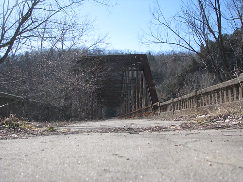
The need for such a road, however, was diminished by 1802 when Downs, along with John Moss, leased Hogan’s ferry and the old ferry at Polly’s Bend shuttered. Hogan’s ferry was at a far better location nearer an offshoot of the old Wilderness Road. Later Hogan’s ferry would close after the Wernwag Bridge opened in 1838. 
According to a History of the Dupree Preserve written by Lisa Conley, it was in 1863 at the site of the old Polly’s Bend ferry where Martha Vaughn and Louisa Jackman risked their lives to deliver important information about Confederate activities to Union forces stationed in Jessamine County. Without their report, “the possibility is that the bridge over Kentucky River would have been burned.” (Affidavit of W.N. Owens).

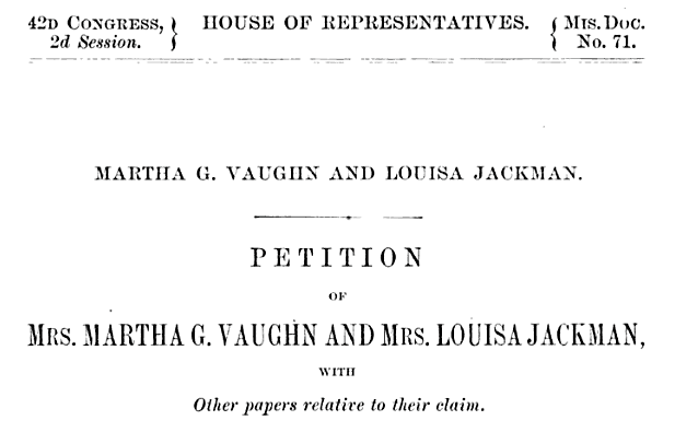
Record of Petition and Papers of Vaughn and Jackman. US House.
For their contributions to the Union, both Vaughn and Jackman sought payment of their private claims by the US government. Their claims were postponed, referred to other committees, and denied on multiple occasions through various Congresses; it is unclear if Mrs. Vaughn or Mrs. Jackman ever received any remuneration for their service.  It was that old Wernwag Bridge which was saved by their heroics.
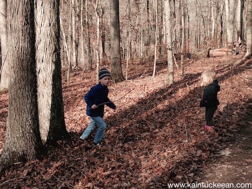
Hiking for All Ages

Spending time outdoors improves both mental and physical health in both children and adults. Research reveals that many cognitive skills are enhanced by giving children the opportunity to experience the outdoors and to exercise. What better place to do this than in a nature preserve?

The kids along the trail among a grove of chinquapin oak. Author’s collection.

Dupree Nature Preserve’s trails are laid out around the various sinkholes and other aspects of the land’s karst topography, but the majority of the trail mileage is easy walking for kids and adults alike. Hiking at this Preserve is suitable for all ages.

Future plans include a dock and a picnic pavilion. The dock could be especially popular as the Preserve is located the 42-mile Kentucky Blue River Trail. But whether you approach the Dupree Nature Preserve by foot or by kayak, it is a terrific place to enjoy a beautiful day in Kentucky.

NoD: Camp Nelson Bridge (v. 2.0)

Camp Nelson
Abandoned Camp Nelson Bridge – Jessamine/Garrard Counties, Ky.

Three bridges have crossed the Kentucky River at Camp Nelson and the pictured bridge was the second installation having replaced a double-barreled covered bridge that  had carried travelers since 1838. Today, this abandoned bridge has been replaced by the less-scenic bridge that has carried four lanes of  US-27 traffic since 1971.

This steel truss bridge features two Pennsylvania-style trusses which span 275 feet over the Kentucky River; with abutments and approaches, the length is extended to 543 feet. When the waters of the Kentucky River are lowest, the bridge rises 60 feet above them. Over 600,000 pounds of structural steel were used for construction, including the 15,000 rivets connecting the I-beams. [*] Bridges are impressive structures and version 2.0 of the Camp Nelson trilogy doesn’t disappoint.

As with all things abandoned, it is a little eerie to walk onto the bridge — completely alone. The rusting trusses and fauna growing through cracks and clumps of dirt give a certain “Life After People” aura. But the spectacular views from this bridge, and the perspective of the three different Camp Nelson bridges is in itself a walk through history.

NoDestination: Tom Dorman Nature Preserve

I wanted to take my sister hiking on the day after Christmas and we were disappointed to find Raven Run closed. No trouble, I thought: we could go to another nearby hiking retreat. The Tom Dorman State Nature Preserve (SNP) encompasses over 800 acres in Garrard and Jessamine Counties (the Jessamine County acreage is not accessible to the public).

The main two-mile loop is described as moderately strenuous, but it is a beautiful walk that follows an old stage coach route. The SNP contains many varieties of trees, several rare species of wildflowers and diverse mammal and reptile populations (other than the trees, I witnessed none of the above).

The most spectacular feature of Tom Dorman is its view of the Palisades. The exposed limestone appears as a mosaic of color and dates to a period when Kentucky was under a shallow sea (thus, marine fossils abound). The Kentucky River began to cut its path through the Palisades about 400,000 to 1 million years ago exposing the ancient Ordovician (450-500 million year old) rock – the oldest exposed rock in the state.

I expect Tom Gorman SNP to grow in popularity. In 2007, the Commonwealth purchased 90 acres of land adjacent to the SNP for the development of Palisades State Park. I hope to visit Tom Dorman again soon (with better equipment than an iPhone!).

Garrard County Courthouse – Lancaster, Ky.

Lancaster is kind of a mess. The traffic is crazy for the size of the town, and its really difficult to get around. Maybe it was the overcast day, or the empty buildings I saw, but Lancaster kind of depressed me.
There is a pretty cool plaque on the courthouse that details the gifts of Captain William Early Buford, a veteran of the American Revolution who gave the original 20 lots and the public square in Lancaster.

No Destination: Garrard County & Lancaster


Nate often mentions how he loves approaching the county seat, scouring the horizon for the courthouse. Lancaster is the perfect example of this. The picture above was taken as we we were leaving Lancaster from the grounds of the Gov. William Owsley’s “Pleasant Retreat.” Owsley, a fiscal conservative, was a major proponent of public education, an opponent of the Mexican War (though he still, as governor, called for volunteers) and was crticized for his pardoning of Delia Webster (who had been convicted of abetting the escape of slaves).

I had never before been past the “Pleasant Retreat,” though I have driven through Lancaster several times before. Each time, I had always been impressed by the little downtown. This time, however, I got out of my car and found walking the central area very challenging. Despite the challenges, little Lancaster had a few bright spots: First Presybyterian Church (established 1816; current structure built 1879 and pictured at right) and the old Garrard County Jail (built 1873, now the Historical Society).

Despite these and a Farmer’s Market (coming soon) and a revitalization of the Grand Theater, Lancaster left me a little disappointed. Apparently, I am not alone. A conversation today with a Garrard Countian revealed the most sobering fact of all: No grocery stores (a sore spot for this particular resident, at least).

No Destination: 5-6-09

I just realized that I never wrote about my first “No Destination” drive. It occurred in early May – immediately after my last law school exam. I picked up two Pepsis and a bag of Fritos and hit the road. The purpose of the drive was simply that – to drive. Consequently, I didn’t take as many pictures as I have on more recent No Destination sojourns.

I traveled down U.S. 27 from Nicholasville past Camp Nelson and across the Kentucky River in order to take KY-152 over Lake Herrington and to Burgin and even further, to Harrodsburg. While I gloss over the drive down 152, one cannot easily forget the beautiful topography of this part of the Commonwealth – rolling hills and seemingly endless praries, streams and rivers.

Once in Harrodsburg, I drove down a busy Main Street with its many shops. The most fun of my trip came up US-127 from Harrodsburg. With an eye open for historical markers, I finally decided to take breaks with my camera. In the small Mercer County ville of McAfee (est. 1779), I saw a nice little church. New Providence Presbyterian – so named because during a 1773 exploration of the area, the McAfee Company neared starvation until a deer was found, killed and eaten. The current church was built from 1861-1864 and the church cemetery was amazing – truly calming.

Down one small road, I saw a farmer using his horses to prepare the soil for tilling. Down another small road, I meandered down to the Kentucky River (and saw a wild turkey!). I’m not sure if I met the river at Warwick or Oregon – each was a ‘major’ shipping port for flatboats and steamboats destined for New Orleans. I sat down a few feet away from the river and watched it pass by. It was exactly the calm I needed. After leaving my spot by the river, I worked my way up a different road (Cummins Ferry) to make my way back to US-127 – then to Lawrenceburg. US-60 to Versailles and then my usual path home to Nicholasville.

I did manage to snap a few pictures:

No Destination – June 5, 2009

Starting out in Nicholasville, we journeyed through Jessamine, Madison, Garrard, Mercer and Boyle counties. Here are some pictures from yesterday’s journey:

As always, there is a lot to learn in central Kentucky.

  • Tates Creek Road in Lexington is the border – for several miles – between Jessamine and Fayette counties.
  • The Valley View Ferry has a “perpetual and irrevocable” franchise issued by the Commonwealth of Virginia in 1785 (that’s why the Virginia flag also flies on the ferry). It has not since ceased operation. It has been operated by Madison, Fayette and Jessamine counties since 1991.
  • “C6, H0” remains visible in Danville to remember when Centre College’s football team (in an undefeated season) beat Harvard, 6-0. It is the only graffiti that the Centre trustees permit on campus.
  • What do they do with the dead? After the October 1862 Battle of Perryville, the Confederate forces quickly fled the area and a mass grave was constructed for the deceased rebel soldiers.