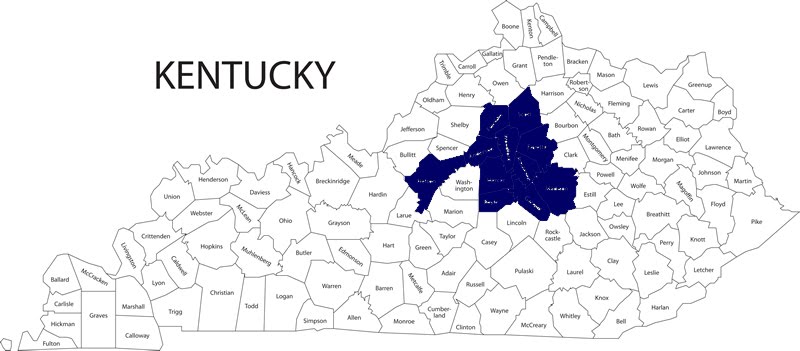
No Destination: Lincoln & Casey Counties


Not only was Stanford a surprise, but several areas of historic Lincoln County prompted me to stop the car.

A historic marker noting the site of McKinney’s Fort: a fort established in 1792 which became an important stop on the Cumberland Trace. The area is now known as McKinney’s Station.

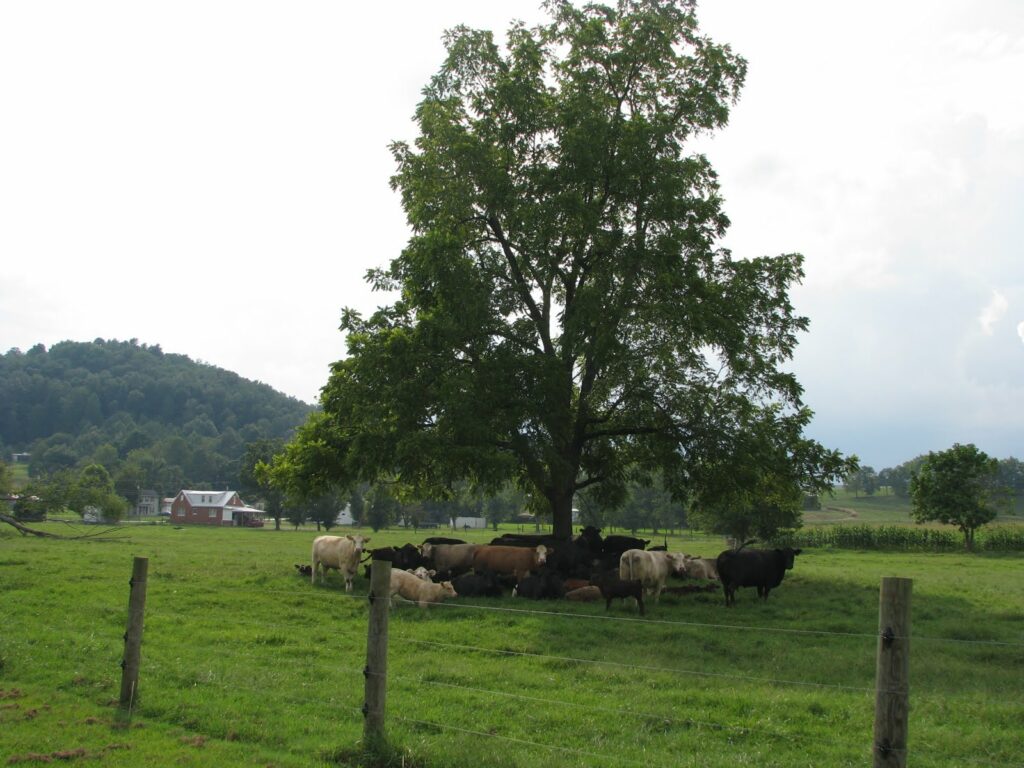
Once in Casey County – just just north of Yosemite – we crossed over an unimpressive tributary of the Green River. A tree under which the cattle relaxed was, however, a beautiful site.

On the return home – but once again in Lincoln County – I spotted a town I wanted to visit: Chicken Bristle. Driving through, there was no sign evidencing the name of this small community. In this rural area, I was surprised to see an old A.M.E. [African Methodist Episcopal] church. I supposed that Chicken Bristle might have been one of the black communities that dotted the region in years past. Sure enough, Chicken Bristle was one of three black Lincoln County communities founded in the post-Civil War era.

Also in Lincoln County was the small community of Hustonville – site of what must be a crazy-scary year-round haunted house.

No Destination: Stanford


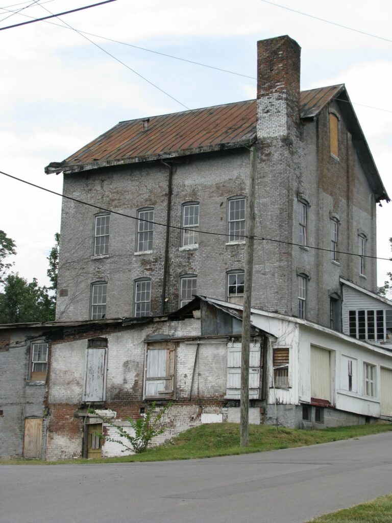
After a disappointing visit to Lancaster, I wasn’t sure what to expect upon my arrival in the county seat of Lincoln County. Adding to my dilemma was that I was immediately drawn to one of the most dilapidated strucutures: the old Baughman Mill. Built in 1884 with logs from the first steam mill in the county, the mill operated until consumer demands and and market supply changed. The mill is located next to the old L&N Depot (which FDR visited while campaigning for President in 1932). In researching for this post, I came across another picture of the old mill taken only last year; note that an entire wing has since been demolished.)

History is very important to Stanford (and to Lincoln County). The county was one of three originally created when the Virginia legislature divided the Kentucky territory into three counties (5 counties existed in 1792 when Kentucky became a state). Stanford is the second oldest community in the state and its Main Street was once part of the Wilderness Road (making it the oldest Main Street in Kentucky).

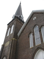
Another neat structure was the First Presbyterian Church – the congregation was organized in 1788 and the structure (original destroyed by a 1838 tornado) was built in 1888. Pictured left, it seems oddly reminiscent of a courthouse.

But history is not all that is left for Stanford. Despite not having rail service for many years, the economy of the county seems relatively strong. The tourism director seemed quite positive and excited about the current state of the county. The optimism seemed warranted – a large, new library is under construction.

No Destination: Garrard County & Lancaster


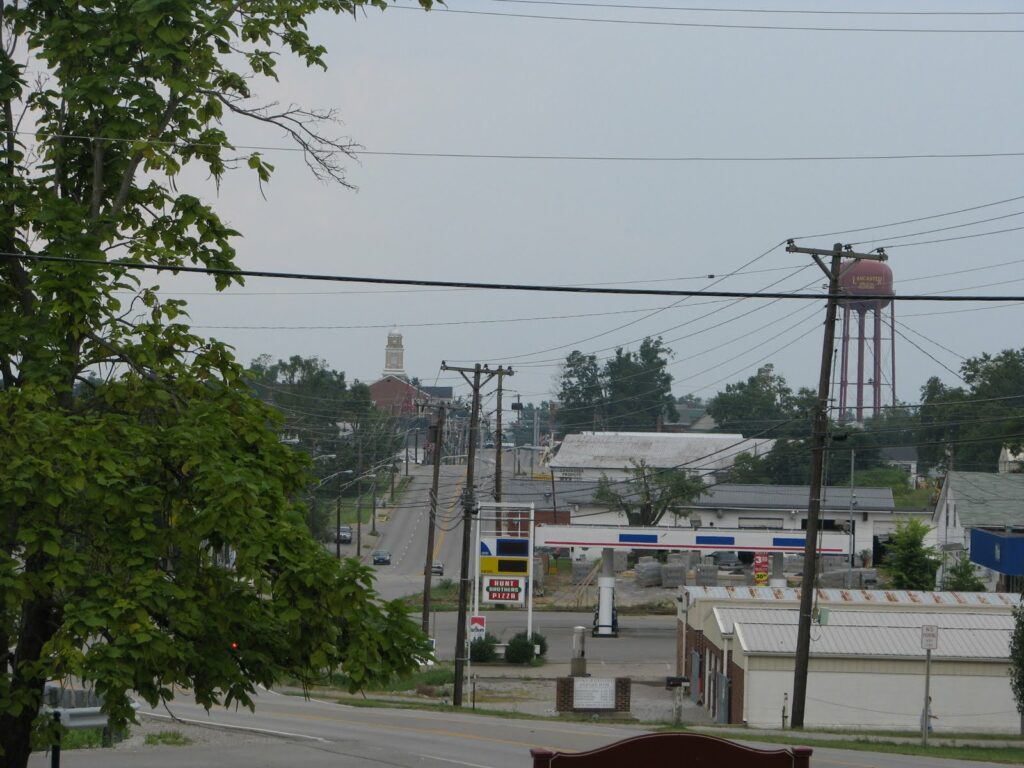
Nate often mentions how he loves approaching the county seat, scouring the horizon for the courthouse. Lancaster is the perfect example of this. The picture above was taken as we we were leaving Lancaster from the grounds of the Gov. William Owsley’s “Pleasant Retreat.” Owsley, a fiscal conservative, was a major proponent of public education, an opponent of the Mexican War (though he still, as governor, called for volunteers) and was crticized for his pardoning of Delia Webster (who had been convicted of abetting the escape of slaves).

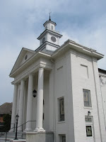
I had never before been past the “Pleasant Retreat,” though I have driven through Lancaster several times before. Each time, I had always been impressed by the little downtown. This time, however, I got out of my car and found walking the central area very challenging. Despite the challenges, little Lancaster had a few bright spots: First Presybyterian Church (established 1816; current structure built 1879 and pictured at right) and the old Garrard County Jail (built 1873, now the Historical Society).

Despite these and a Farmer’s Market (coming soon) and a revitalization of the Grand Theater, Lancaster left me a little disappointed. Apparently, I am not alone. A conversation today with a Garrard Countian revealed the most sobering fact of all: No grocery stores (a sore spot for this particular resident, at least).

No Destination: Nicholasville

I traveled with Nate on a Courthouse tour and walked around four communities. Often, I would get out of the car a few blocks away from the courthouse and explore the little towns for about 20 minutes. Also, No Destinations will begin to examine the landmarks found rather than only the day’s journey. This should allow me to delve into each discovery a little more.

Nicholasville was named after Col. George Nicholas, a veteran of the Revolutionary War who authored Kentucky’s first Constitution. The city was laid out in 1798 – the same year in which Jessamine was carved from Fayette County. A number of historic churches are within a block of the courthouse, but it is the courthouse that dominates this little ville.

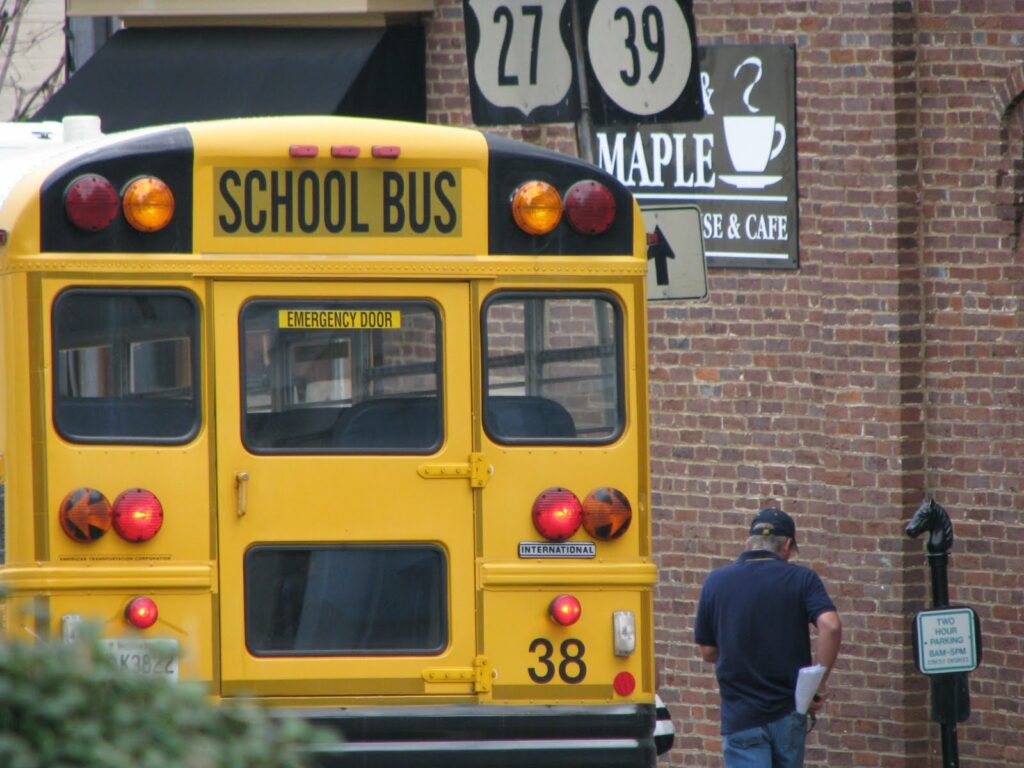
Being a resident of little Nicholasville – one of Lexington’s bedroom communities – is both a blessing and a curse. Despite its pitfalls, however, Nicholasville’s central business district is improving and has several great little jewels. One of those jewels is Main & Maple, a small coffee house and cafe that is housed in a renovated pharmacy. I pictured a corner of Main & Maple above along with the school bus. Despite its storied past (look for a future post on the Chaumiere des Praries), I feel that this picture captures the pace and attitude of Jessamine, i.e., a working class bedroom community with schools and a few other things too.

No Destination: Jessamine (Aug. 16, 2009)


With thirty minutes to kill, I went for a quick drive today in my home county of Jessamine. I picked a couple of roads I had never before traveled – and, as always, was amazed at what I saw.

Corn fields to the left and right, access to a beautiful creek with rapidly moving water (I love the sound of moving water) and a small, country Baptist church. Even standing outside, I could imagine earlier in the day the Bible-preaching going on in that small country church. Here are a selection of the few pictures taken from the trek:

Also, I realized something really cool. My new iPhone knew exactly where I was when I took the pictures so they were automatically geotagged. Pretty cool.

A No Destination Map

Filling in the map for the Kentucky120 Project is much more definite than doing so for No Destination. Of course, that’s because the Project has a specific goal in mind – the courthouse of each county.

No Destination meanders, wanders down Kentucky paths – beaten or otherwise. I’ve been to many of Kentucky’s other counties, but I won’t claim it as a No Destination unless it gets at least a mention here.

No Destination: 5-6-09

I just realized that I never wrote about my first “No Destination” drive. It occurred in early May – immediately after my last law school exam. I picked up two Pepsis and a bag of Fritos and hit the road. The purpose of the drive was simply that – to drive. Consequently, I didn’t take as many pictures as I have on more recent No Destination sojourns.

I traveled down U.S. 27 from Nicholasville past Camp Nelson and across the Kentucky River in order to take KY-152 over Lake Herrington and to Burgin and even further, to Harrodsburg. While I gloss over the drive down 152, one cannot easily forget the beautiful topography of this part of the Commonwealth – rolling hills and seemingly endless praries, streams and rivers.

Once in Harrodsburg, I drove down a busy Main Street with its many shops. The most fun of my trip came up US-127 from Harrodsburg. With an eye open for historical markers, I finally decided to take breaks with my camera. In the small Mercer County ville of McAfee (est. 1779), I saw a nice little church. New Providence Presbyterian – so named because during a 1773 exploration of the area, the McAfee Company neared starvation until a deer was found, killed and eaten. The current church was built from 1861-1864 and the church cemetery was amazing – truly calming.

Down one small road, I saw a farmer using his horses to prepare the soil for tilling. Down another small road, I meandered down to the Kentucky River (and saw a wild turkey!). I’m not sure if I met the river at Warwick or Oregon – each was a ‘major’ shipping port for flatboats and steamboats destined for New Orleans. I sat down a few feet away from the river and watched it pass by. It was exactly the calm I needed. After leaving my spot by the river, I worked my way up a different road (Cummins Ferry) to make my way back to US-127 – then to Lawrenceburg. US-60 to Versailles and then my usual path home to Nicholasville.

I did manage to snap a few pictures:

No Destination 8-8-09

It might be a stretch to call this post a “no destination.” I was in Bardstown, Kentucky for a wedding this past Saturday and I had about an hour-and-a-half to kill. I headed into downtown, parked the car and began to explore.

Bardstown is best known as the site of Federal Hill, a/k/a My Old Kentucky Home. Relaxing on the grounds of this property, composer Stephen Foster wrote the words and music of the song that would become Kentucky’s state anthem.

Downtown is marked by a large rotary with the old courthouse in the middle. Bardstown, a ville strongly focused on historical preservation, now uses its old courthouse as a visitors center. (The new courthouse is not downtown; it’s next to the Bluegrass Parkway.)

The focus on historical preservation is everywhere – older homes and business are marked with plaques indicating the history of the structures. All in all, Bardstown is a great little ville. I hope to return to see the proto-cathedral of St. Joseph; apparently Bardstown was an important center of American Catholic life.

Without adieu…the pictures (be sure to read the captions):

Oh, and one more interesting fact. The first successful leg amputation (at the hip joint) was performed on a 17-year-old patient in Bardstown in 1806.

No Destination – June 5, 2009

Starting out in Nicholasville, we journeyed through Jessamine, Madison, Garrard, Mercer and Boyle counties. Here are some pictures from yesterday’s journey:

As always, there is a lot to learn in central Kentucky.

  • Tates Creek Road in Lexington is the border – for several miles – between Jessamine and Fayette counties.
  • The Valley View Ferry has a “perpetual and irrevocable” franchise issued by the Commonwealth of Virginia in 1785 (that’s why the Virginia flag also flies on the ferry). It has not since ceased operation. It has been operated by Madison, Fayette and Jessamine counties since 1991.
  • “C6, H0” remains visible in Danville to remember when Centre College’s football team (in an undefeated season) beat Harvard, 6-0. It is the only graffiti that the Centre trustees permit on campus.
  • What do they do with the dead? After the October 1862 Battle of Perryville, the Confederate forces quickly fled the area and a mass grave was constructed for the deceased rebel soldiers.

No Destinations – May 27, 2009

On May 27, we started in Fayette County and drove through Woodford, Franklin and Scott counties. It was a fun drive with an in-depth exploration of downtown Frankfort – the state’s capital. Learned:

  • Bibb lettuce was developed in Kentucky
  • Kentucky has an “official” covered bridge; it is the Switzer covered bridge in Franklin County
  • Justice John M. Harlan, the lone dissenter in Plessy v. Ferguson (the case established the “separate but equal” doctrine, which was repudiated in Brown v. Board of Education; ) , lived for a time in Frankfort. In his famous dissent, Harlan wrote: “But in view of the Constitution, in the eye of the law, there is in this country no superior, dominant, ruling class of citizens. There is no caste here. Our Constitution is color-blind, and neither knows nor tolerates classes among citizens. In respect of civil rights, all citizens are equal before the law.”