I found myself discovering the western Kentucky of Paducah a couple years back in what was my first (and only thus far) trip to the Purchase. As you travel westward in Kentucky from the Bluegrass toward the Purchase, you realize the vastness of Kentucky (though, as a state we are only 37th in terms of square miles, and thus not particularly vast). Though it takes little time to traverse Kentucky from its southern border with Tennessee to either Illinois, Indiana, or even Ohio, the trek from “Pikeville to Paducah” is a easily a six-plus-hour drive.
But Kentucky’s vastness is not just in that east-west distance, but in the variety of terrain experienced across the landscape. Louisville is often carved out as not being particularly Kentucky-like, but the hills of eastern Kentucky couldn’t be more different than the open flatness of the Purchase. Here, the region is defined by water with the convergence of the Tennessee River into the the Ohio River, which in turn flows into the mighty Mississippi. These waters have huge impacts on commerce, culture, and the land itself.
Here in Paducah one encounters, I claim, an agreeable blend of Western kindliness, and Northern enterprises, superimposed upon a Southern background. Here, I claim, more chickens are fried more hot biscuits are eaten, more corn pone is consumed, and more genuine hospitality is offered than in any town of like size in the commonwealth.
Author, journalist, and native of Paducah Irvin S. Cobb
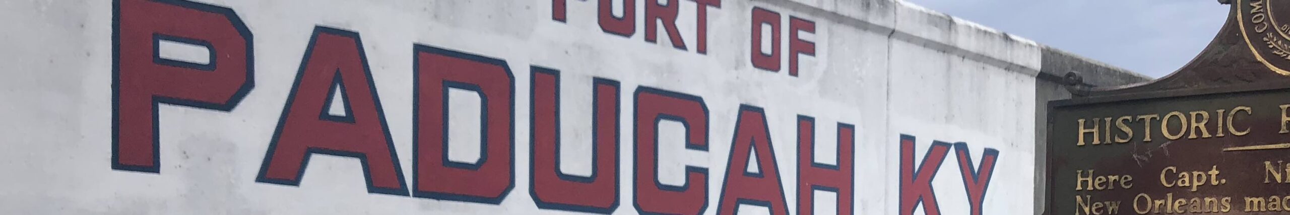
Port Paducah
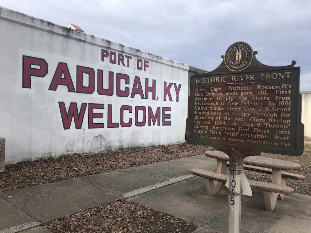
The city of Paducah itself is separated entirely from the Ohio River by a series of flood walls. Without, the city would be vulnerable to constant flooding. The flood prone city experienced natural disaster with regularity, but none like the Great Flood of 1937. This natural disaster began with eighteen inches of rain which put the river more than 10 feet above flood stage. The river stayed above flood stage for nearly two weeks, the earthen works having been a total failure. Following this flood, Congress called upon the Army Corps of Engineers to build the existing flood wall system.
An earlier flood in the 1884 brought the founder of the American Red Cross, Clara Barton, to Paducah where the organization (founded in 1881) conducted its first flood relief operation. The organization assisted the nearly 30,000 refugees from the 1937 flood as well.
A historic marker on the outside of the flood wall highlights three historic events which occurred at Port Paducah:
- Gen. George Rogers Clark visited this spot, 1778
- Gen. Ulysses S. Grant landed here Sept. 6, 1861 to occupy Paducah for Federal Union.
- Capt. Jack B. Sleeth laid first successful submarine cable, 1847. It reached from Campbell St. to Illinois shore.
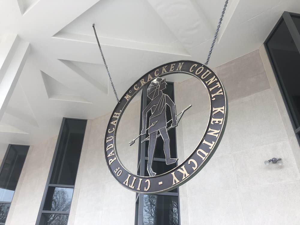
A City and its Hall
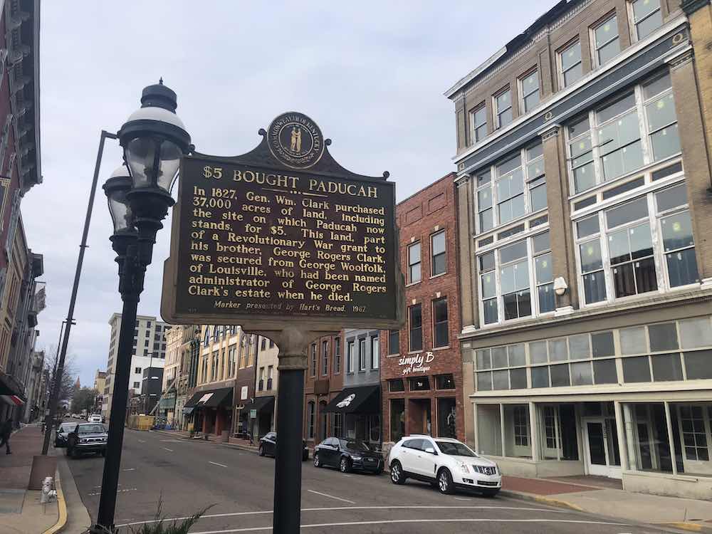
The land on which the city of Paducah was laid was purchased for by General William Clark as part of an acquisition from the estate of his brother, George Rogers Clark. The purchase price for the 37,000 acres? Five dollars.
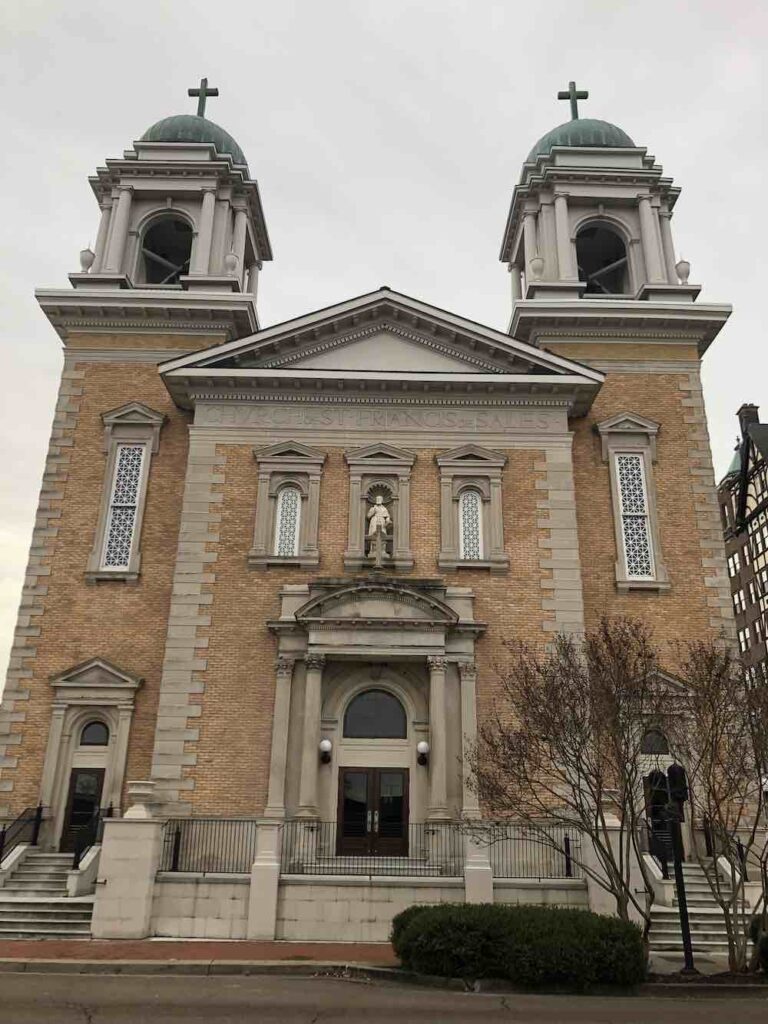
The majority of Paducah’s buildings do not reach the heavens with the exception of one building in the Tudor style and the magnificent Catholic Church of St. Francis de Sales.
I would suggest that a significant reason for this is that municipal functions were located on the edge of town in the middle of the 19th century and that trend was continued into the 20th century. In 1825, the first courthouse for McCracken County was built at Wilmington, Kentucky, before being located to Paducah in 1832. In 1861, the courthouse was moved to its present location then at the “edge of town” with the current courthouse having been built in 1943. (Wilmington was about two miles west of Paducah, but the county seat was moved due to persistent flooding.)
Closer to the Ohio River but not far from the courthouse is the city’s municipal building which was first opened in 1964. It is arguably the most significant city hall in the entirety of the Commonwealth.
The City Hall building was designed by Edward Durrell Stone who was one of the most significant architects of the 20th century. His mid-century municipal building was described as being in the New Formalism design and was completed in 1964. In 2015, Janice Rice Brother penned the following article as the city of Paducah was determining what to do with this architectural landmark.
Edward Durell Stone and Paducah’s Vision for the Future: What Now?
Fortunately, the City Hall was rehabilitated and my visit to Paducah occurred as the renovation was underway. Following the completion of the structure’s restoration, it received multiple awards and accolades. It was also placed on the National Register of Historic Places. (Source: City of Paducah)
My time in Paducah was limited and ill-timed in the cold of winter when the sights and tastes I most wanted to experience were closed due to my Sunday-Monday timeline. Even so, I caught a glimpse of another Kentucky community with a lot to offer.