
 |
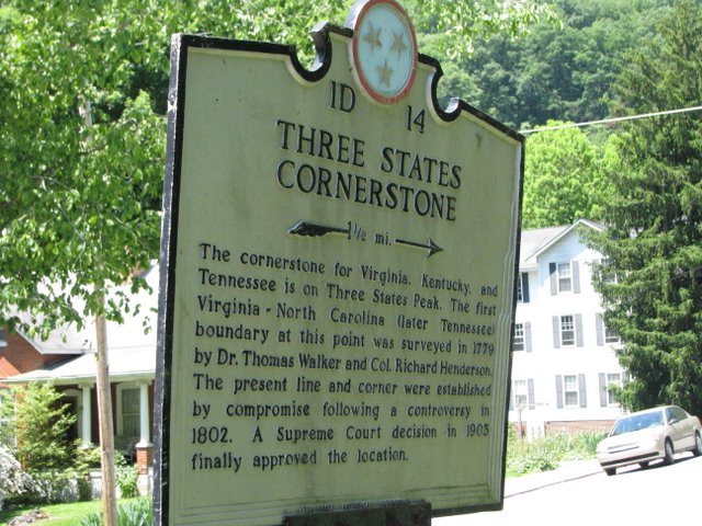
| Near the Boundary Marker of TN, KY & VA in Cumberland Gap, Tenn. |
At the top of Tri-State Peak is the cornerstone of Virginia, Kentucky and Tennessee. Dr. Thomas Walker and Colonel Richard Henderson first surveyed this site in 1779. A National Historic Civil Engineering Landmark marker notes the Royal Colonial Boundary of 1665. The marker is at an elevation of 1,990 feet.
When Dr. Walker, for Virginia, and Col. Henderson, for North Carolina, surveyed the land, the two states disputed the rights to lands west of the mountains. The region was proposed to be part of the never-successful colony of Vandalia and the non-state of Westsylvania. Also, Col. Henderson is the same who purchased the non-state of Transylvania from the Cherokee in 1775, but which purchase was invalidated by Virginia the following year. The present state lines and boundaries were settled by compromise in 1802 and the Supreme Court’s decision, Tennessee v. Virginia, 190 U.S. 64 (1903), finally approved the location.
From the Tennessee roadside marker pictured above, it is only 1.5 miles to Bell County, Kentucky and the Tri-State Peak.